Categories: all aviation Building a Biplane bicycle gadgets misc motorcycle theater
Fri, 04 Mar 2022
The End of an Era (and the Beginning of Another)
As I write this, I am sitting in a cut-rate motel near Lakeland, FL. I have finally seen, in person, my new airplane. It is lovely. It is a biplane. It is a Marquart Charger. I'll take a test flight tomorrow, and sign all the documents to make it mine.
I knew when I bought Norbert the Champ that it wouldn't be my airplane forever. I knew it was something of a starter plane, though I didn't have a specific path forward in mind. I kind of figured I'd end up selling it to get an IFR-capable plane, so I could get my instrument license to facilitate flying down to visit my parents more often.
The thought of replacing it with a Charger is pretty damn cool.
But it brings to mind all the neat stuff I've done with Norbert. We flew to Oshkosh, spending three weeks traveling most of the way across the country, and seeing the world's biggest airshow. That was 2019. Before that, in 2017 and 2018, we did two big trips to California, one of them to visit my brother in LA, the other to visit my cousins in the Bay Area, and my friend Alex in Humboldt.
I've taken Norbert up to the San Juan islands more times than I can count. I've flown many friends (though not lately), taking them up for a little trip somewhere (out to the northwest tip of the state, at Quillayute, or up to the islands, or down to Olympia to pick up a friend just so we could go up to Port Townsend for pie). So much pie. I have eaten so much Spruce Goose Cafe pie because of Norbert.
In many ways, it is an ideal little plane for me. It's small and unimposing. It's slow, but also docile and forgiving, and kind when the pilot might not be the most coordinated klutz in the sky. It's classy looking, in its way, with the poorly conceived but very attractive black and green dope (lovely to look at, but exactly the same colors as the scene of a crash in so many places around the PNW where there are trees, making perfect camouflage; the opposite of what you want in a rescue situation). It's very well-equipped, now that I've had my nefarious way with it: a new ADS-B transponder, a new radio, and a new engine monitor, plus it's been well kept up and stored in a very protected hangar. I like to think, even electronic toys aside, that I'm selling it on better than I found it.
For that is the final calculus: I must sell Norbert the Champ. I'll have a for-sale page up soon. I can't afford to keep two airplanes, so the old one has to make space for the new one. It's been a very good plane for me, and I will always regret letting it go, but I would also regret letting this new Charger get away, and it offers me a great set of new opportunities, chief among them having an actual living, breathing Charger to examine to see how it's built; and giving me the opportunity to build up hundreds of hours on a Marquart Charger, making the first flight of the Charger I'm building much less of an Event than it might otherwise be.
So it is with great fondness that I consider this to be the final days of my time with Norbert the Champ. We've done wonderful things together, and I know you will go on to the next owner who will discover all the wonder and happiness to be had by puttering about the sky at a leisurely 85 MPH.
Posted at 17:49 permanent link category: /aviation
Mon, 07 Feb 2022
The weather was stunning yesterday, so I ended up taking a lot of pictures when I flew to Friday Harbor. I laid them all out in a sort of photo essay. Enjoy!
A Lovely Flight to Friday Harbor One Sunday
Posted at 11:54 permanent link category: /aviation
Tue, 14 May 2019
Norbert the Champ has been ailing a bit in the last few months. I've been flying every few weeks, as the weather allows, occasionally letting a whole month pass between flying dates. The problem is, when the engine sits like that for long periods, it gives condensed water a chance to attack the innards and start creating rust.
The accepted remedy for this problem is to fly more often (how convenient!). The idea is that by flying, you warm up the oil, and encourage the water to evaporate out, as well as getting a fresh coat of oil in all the places it's supposed to be. Ideally, you want the oil to be 180-200°F for at least half an hour to get the water out.
Fortunately, I haven't noticed Norbert's ailment in the sense of feeling like anything's wrong as we fly. Rather, I've been noticing that the crankcase breather tube is drooling a bit of oil/water mixture after flights. I'll come back a week or so later, and there's a 2" pool of mocha-colored oil-water emulsion sitting under the engine, almost exactly like it had a little potty training accident.
The plane is equipped with an air-oil separator, which is a little thing the size of a beer can which is supposed to condense the oil out of the crankcase breather tube, and let it drain back to the oil tank, rather than sending it out over the belly of the plane in flight. It seems to work pretty well, but this new pool of oil was worrying.
Did it mean the separator needs to be cleaned? Did it indicate some other problem inside the engine? The oil on the dipstick came out looking like oil (good) and not like mocha foam (which would be bad), so I wasn't sure.
Finally this last weekend, I got a chance to chat with the local mechanic about it, and his recommendation was to go fly the plane a bit to warm up the engine, then do a compression test. This would confirm whether any of the cylinders were leaking more than they should. Previous compression tests (we do one at least every year) have been good, but this one showed that the #4 cylinder was down a little bit. Apparently the ideal number is 79 out of 80, with a full 80/80 indicating a problem, and anything down to about 40/80 being in the acceptable range (this is hard for my perfection-oriented brain to comprehend, but apparently is true).
After the compression test, the A&P mechanic said, "Frankly, what I'd recommend is that you go out and fly for a while at higher power, like a high-power cruise. That'll probably improve this, though even 72/80 is pretty good." This actually aligned well with my thoughts on boiling the water out of the oil, so I set out to see what I could do.
Norbert and I launched into the warm May day (it was over 80°F that day), and I set out to fly it like I basically never do.
The first order of business was not to climb too high. Normally I'm in the "altitude is insurance" game: the higher you are, the more gliding distance you have if anything goes wrong with the engine. However, the air is thicker and hotter down low, so I mentally plotted a course over a set of flat fields through the Snoqualmie Valley.
The next thing was to push the engine faster than normal. I've settled on a fuel-sipping 2200 RPM cruise (2500 is the maximum, or nominally 100% power), which probably represents around 60-65% power. I've been burning about 5.5 gallons per hour at this setting, which seems like a nice level. I have no idea how much fuel we'd actually burn at higher power, but presumably around 8-10 GPH, which is a lot for a 90 HP engine on a plane like this.
So I launched from Harvey and aimed myself southeastwards. It was interesting to see what happened.
I set myself up for about 1700 feet of altitude, which puts me safely over the legal limit, but not so high that I was losing much heat from the ground-level air. I pushed the power until it was just shy of the 2500 RPM redline limit. The plane made a constant shimmy and judder feeling, very light, but enough to communicate to me that it wasn't happy. The louder engine noise combined with increased wind noise to give a sonic edge to the plane's discomfort. We ended up cruising around 105-110 MPH, vs. my normal 85 MPH at 2200 RPM. Gratifyingly, the oil temperature kept rising, finally stabilizing just below the 200°F mark -- I haven't seen over 150° since last summer. Maybe I have been under-working the engine.
I flew most of the way to North Bend, then turned around over Carnation and flew back, circling once over a friend's house, and then looped back around to Harvey Field. I briefly lowered the engine back down to 2200 RPM and let it settle into its happier cruise speed. It was remarkable how much more comfortable the plane felt. Then it was back up to nearly 2500 for the return to Harvey, and an uneventful landing.
In all, just shy of an hour's flight time, almost all of it spent at just shy of full power. Out of curiosity, I checked the fuel left in the tanks -- I'd taken off with around 21 gallons -- and found there were about 14 left. 7 GPH for nearly full throttle. I had expected more, and would probably plan on at least 8 if for any reason I had to fly for any distance at full throttle; part of my hour's flying time included taxiing on the ground. My fuel dipstick measurement technique is fairly crude, and will never be more accurate than within about a gallon or two (gas cans always seem come in frustrating "gallon plus 3 ounces" sizes to accomodate people mixing 2-stroke fuel, making accurate measurement very difficult).
I was able to visit the plane Tuesday night after the flight on Saturday, and found a small puddle of discarded oil, fortunately not as mocha-colored. There is a distinct trace of oil running down the belly, but it's coming from somewhere in the engine compartment rather than from the breather tube.
A very interesting experiment in Going Fast with my pal Norbert. My key takeaway is that I should probably be running the engine harder for its own good health. The slightly increased fuel burn is a fair trade-off for not having to overhaul the engine (a $25,000 proposition) early.
Posted at 22:21 permanent link category: /aviation
Sun, 21 Apr 2019

The Washington State Department of Transportation and a bunch of aviation organizations just released the Fly Washington passport program. Basically, it's a program where you get a free "passport" booklet which contains a bunch of blank spots organized by region of the state, and your job is to fly to different airports and fill out the passport. Apparently there's some kind of prize at the end if you fulfill a set of requirements.
The goal of the program is to encourage aviation, and particularly to drive traffic to smaller airports that have been suffering from lack of use in the last decade or two.
I'm here to tell you, I love this kind of thing. I always envied people who had passports full of visa stamps; there's just something so satisfying about all those stamps from all those places. It's not even the places that appeal to me, just the sheer collector-impulse OCD satisfaction of pages covered in stamps. So I fell for the Washington aviation version hook, line and sinker.
Despite what it says on the official page, it appears that most airport offices have at least a handful of passport booklets available. You don't have to go exclusively to the four official places to pick one up. I was able to get one at the Harvey Field FBO office, and they had a stack of at least ten more ready to give away. At least here at the start of the program, it's worth asking at your local airport.
Norbert at the Darrington Airport (1S2)
This weekend was my official entre into the passport stamp game. I managed to hit five different airports over two days -- yesterday I flew up to Lynden to visit a friend, and today I took the afternoon to specifically go out and collect some stamps, eventually stopping at Arlington, Darrington, Paine Field, and Harvey Field. I expect to have more days like this over the summer, where I just go flying for the day and hit new airports I haven't visited recently, simply to collect the stamp.
The thing is, from what I can tell, pilots will grab at nearly any excuse to go flying. It acts nearly like an addiction. "Gotta go collect some stamps" is a ready-made excuse, and seems to me like an excellent way to get a bunch of pilots into the air and visiting airports far and wide across the state.
On today's flight, I started out at Harvey as usual, and grabbed the stamp from the office, where it's temporarily being kept until they set up an external station for it. Then it was off to Arlington for my next stamp -- Lynden was collected yesterday. Arlington was interesting, because the wind changed direction as I was fuelling up, then Norbert's carb heat seemed to malfunction at the run-up check. I pulled back around to a taxiway, shut down, and did a quick visual check -- everything looked right, and on the next run-up it worked like it should. These little Continentals apparently ice up at the slightest provocation, so a malfunctioning carb heat system is a big deal.
From Arlington, I had to ponder where I wanted to go next. Norbert is still limited by a lack of blinkenlights, which keeps it from being legal for night flight, so I had to be back to Harvey before the sun set. That ruled out any longer flights, but as I was looking at the chart, I realized that Darrington was only about 25 nm away, and I'd never been there before. That seemed like an ideal destination, so I launched and turned northeast from Arlington.
The Darrington airport is a very small strip set near downtown Darrington -- Darrington is a town of about 1400 people, so "downtown" is a relative description. Nevertheless, the airstrip is right in the middle of town. I was interested to see runway lights and a beacon: I had flown (in a different plane) out to the Concrete airport a few years ago hoping to watch a meteor shower from a very dark place, but Concrete didn't have runway lights. Darrington isn't quite as dark, but the ability to actually land at night overcomes that downside to some extent.
The wind was blowing pretty strongly from the west, so I set up for runway 28. I actually overestimated the amount of wind the first time around, and wound up too high to land, so I went around and tried again rather than try to salvage an obviously flawed landing approach. Once I got down, I parked the plane next to a helicopter with a massive boom strapped to the skids, which looked like it hooked up to some kind of geological sensor box. The stamp at Darrington is located in a "small box on the beige hangar" -- with the aid of the photo on the passport website, I realized it was what looked like a discarded electrical junction box. I gathered my stamp and took a few photos. I found Darrington to be a surprisingly delightful little airstrip.
The flight back was not as daunting as I'd feared (I was expecting the headwind coming up the valley to really slow me down, but it wasn't bad), and I realized that it was only 7:20, and I had ages until sunset (8:03 pm), so why not pack Paine Field into the flight? I entered my best powered-descent mode, hitting 115 MPH (normal cruise is about 85, so this is screaming for Norbert) as I made tracks for Paine's traffic pattern.
Once on the ground, the Paine ground controller didn't know about the passport stamp, so I stealthlily looked it up while doing a very slow taxi. I called the ground controller back, and after a few minutes of mutual confusion, they got me directed to the right spot, right next to Regal Air. I leapt out of the plane, ran into the flight planning space, stamped my passport, and dashed out again. Norbert was swung 180° and shuddered to life again -- that sun seemed to be accelerating toward the horizon as a cloud bank suddenly hid it from view, and the moment of sunset is my official cutoff.
Fortunately, there was no waiting to get to the runway, and I was off the ground having only spent about 10 minutes between landing and takeoff -- that's definitely a record for me. I managed to touch down at Harvey with nearly 5 minutes to spare, and relaxed with a celebratory snack as I watched the sky fade from blue to pink to purple over Norbert's nose. I had spent a mere 14 minutes between starting the engine at Paine and shutting it down at Harvey.
Flying continues to be a surprisingly potent source of happiness for me. It finally took finding my own airplane to really get into the groove of things, but I'm glad I did. Now I just have to plan out the next few batches of passport stamps I need to go for...
Posted at 22:48 permanent link category: /aviation
Sat, 23 Mar 2019

Image by Chris
Kennedy, used under CC BY-NA 2.0 license
I found myself with some free time a couple days ago, and decided to take Norbert the Champ up. There was an occluded front due in the afternoon, so I had to abandon my original plan to fly over to Port Townsend (0S9) for a late lunch. Instead, I decided to do some pattern work and possibly some turning-stall work in the practice area. I wanted to stay close to the field so any nasty weather that turned up wouldn't catch me away from home.
According to the new weather robot at Harvey Field (S43), the wind was blowing about 180-190°, and between 10 and 15 knots in gusts. The closest runway is 15L, so there was a bit of crosswind, but nothing terrible. The gusts made things more interesting, but fine practice for me -- I rarely get to take off and land with crosswinds and need all the practice I can get.
One of the members of my EAA chapter has been developing a pretty cool program aimed at experimental (homebuilt) aircraft, to determine and then correct low-speed stall characteristics. Specifically, he's worried about the base-to-final turn, which is the closest to the ground most pilots will ever turn, and thus the one most fraught with danger should anything go wrong. He recently lost a friend to a likely stall-spin accident on a base-to-final turn, so his idea has received fresh momentum.
Something he mentioned recently was that most pilots haven't explored their aircrafts' stall characteristics except the most basic straight-ahead power-on and power-off stalls. Stalls while turning can be very exciting, easily leading to a spin -- a condition which may be unrecoverable at low altitude, and a prolific killer of pilots in the beginning years of aviation. I realized that not only did I not know my plane's behavior in this condition, I'd never done a single turning stall in my entire flying career.
The setup for these stalls is exactly the same as normal stall practice, except the plane is turning. Add at least another thousand feed of altitude compared to normal stall practice, just in case. A spin can develop very quickly, and the extra space gives you a bit more breathing room to recover if it surprises you. It would be best to have experience recovering from spins and recognizing incipient spins before trying this yourself, but read this handy article on spin recovery at a bare minimum. I spent several hours doing spin recovery training with a CFI a few years ago, which makes me barely competent, but I felt safe enough to give turning stalls a try.
The first thing I tried was power-off turning stalls. I figured, correctly, that with less energy involved, things would be a bit calmer. So I set up for my normal descent to landing -- carb heat on, power to idle, and enter a 20-30° bank to turn from downwind to base. Since I didn't know exactly when the stall might happen, I put myself into a constant rate turn, kept the ball centered with the rudder, and pulled back on the stick. With the hand grip buried in my belly (I really need to get rid of that thing; the belly, not the handgrip) and maintaining a nearly 45° bank angle, the plane simply refused to stall. Just to eliminate the possibility that the 7EC Champ is more resistant to turning stalls to the left than to the right, I climbed back up to 4000 feet and tried again, this time circling to the right. Nope, no stall.
Surprised, I climbed back up to 4000 (the Champ didn't seem to be stalled, but it was definitely going down quickly, losing 700 feet in what felt like maybe 45 seconds) to try power-on turning stalls.
This time, I set up for a fairly unrealistic 45° bank coordinated turn at full power, and held the stick full back until I got a definite stall break. To my complete surprise, with the stall, the plane rolled sharply away from the direction of the turn, trying to roll into an opposite-direction turn and possibly stall/spin (I stopped it before it could develop). I tried in the other direction: same thing. Weird.
I haven't yet figured out the aerodynamics of what might be happening with the power-on turning stall, but I was interested to see that it also seems to happen with the 7AC Champ model in X-Plane. My understanding was that X-Plane treats stalls in a somewhat unrealistic manner, since the aerodynamics get pretty tricky around stalls, and it's hard to simulate them properly. It's cool that the simulator mimics real life in this situation.
My EAA member's idea (I'm not naming him because the program isn't official, and I'm not following it, just inspired by the discussion) with his base-to-final stall/spin reduction, as I mentioned earlier, is that pilots of homebuilt aircraft should explore their planes' stall characteristics, including in a turn, like I did. Once it's determined whether the plane wants to drop a wing in a stall (leading to a spin), apply appropriate anti-stall modifications to the wing, such as vortex generators, stall strips, etc. to correct the behavior. This should lead to a safer and more predictable plane. It's a great idea, and I'm glad he's working on it.
I'm equally glad that I tried out a couple of turning stalls to see what would happen in my plane. The results were very surprising to me, both the fact that the plane didn't want to stall in a turn with the power at idle, and the manner in which it stalled with power on. I may spend some time exploring the power-on stall a bit more, to see if I can figure out what's going on with the airflow that causes the plane to flip around like it does. I'll continue flying well away from the potential danger zones of the stall. I'm glad to learn another bit of knowledge about how my plane behaves.
Posted at 23:00 permanent link category: /aviation
Thu, 13 Sep 2018

My work sent me on a trip to Orlando recently, and I checked in with folks on the Biplane Forum to see if there was anyone who's be interested in showing off a project, or if there was some aviatory attraction I should definitely see. I got a few suggestions, but by far the most appealing one was to visit a set of three Chargers at the Ormond Beach (OMN) airport.
My work duties were finished around 5 on the day of my visit, and I was rolling by about 5:20. Unfortunately, from where I was, it would be at least an hour and a half drive, and traffic at 5:20 on a weekday meant there was an additional ten minutes of delay. Silently cursing as I passed through Florida's plethora of poorly-explained road toll booths, I made it to the airport around 7.
I met D., who had made the invitation initially, at the gate, and he introduced me to a crowd of folks, all of whose names have already disappeared from my fickle memory. I think two of them were Charger owners, D. used to own a Charger, and there was one owner who wasn't at this particular event. They were gathering anyway for a birthday celebration for R., who I ended up talking to after my flight.
D. looked up at the sky and said, "Let's get you up before sunset!" We pulled his plane out, and climbed in. I found that I mostly fit in the front cockpit, but the rudder pedals were uncomfortably close. I still managed to fly the plane just fine, but I wouldn't enjoy a long cross-country in the passenger seat.
I had an airspeed indicator, an altimeter, and a tachometer as my instruments; a control stick, rudder pedals, and throttle as my controls. We taxiied out to runway 8, and after a brief run-up, launched into the humid, warm air. D. gave me the plane as soon as we were out of the traffic pattern around OMN, and told me to stay around 1000 feet to keep under the Daytona Class C, and then we could climb once we hit a particular body of water.
We got to our mark, and I sent the throttle forward. The plane didn't scream upward, but it climbed with more vigor than Norbert the Champ would have. Looking out over the short twin wings was a little strange -- Norbert's wings are 5 feet longer in each direction, and there's only the one on top.
I was more relaxed than I had been in the other Charger I've flown in, probably because I was over the first-time jitters. I found that the plane responded quickly to control inputs, and felt like it was shorter in all dimensions than the comparatively pokey Champ, which is true. Ailerons rolled the wings faster, the rudder swung the tail more aggressively, and the elevator pointed the plane up and down with greater speed and less pressure. It also struck home how much more comfortable the stick arrangement is in the Charger: in the Champ, the stick pivots below the floor, and although this is very neat and trim looking, it means the stick swings pretty far in all directions. The Charger has the stick's pivot above the floor, so you can see the workings of the system.
I tried a variety of maneuvers, dancing around the puffy clouds that dotted the sky: a power-off stall, a power-on stall, steep turns, a slip, a dive, etc. The power-off stall was almost shocking in how gentle it was. It wasn't properly a stall at all -- we were clearly going down while aiming up (or at least level), but there was no break, and I had a sense that at least one of the wings was still flying. The power-on stall was much more interesting, breaking distinctly and dropping the left wing promptly. A release of pressure and a touch of rudder straightened the plane back up, and we were flying again. The steep turn was unremarkable and quick. The slip was pretty weird: unlike the Champ, which seems to be designed to slip, the Charger wouldn't plunge over at 45° and drop like a rock. I could get it over about 20° then ran out of rudder, and it didn't seem to go down appreciably faster than just slowing the motor down and coasting downward. I suppose the advantage would still be that you could descent without gaining extra airspeed, but a slip was definitely where the Champ is the more capable plane.
The wind in the cockpit was basically unnoticeable. It was there, and in cold air I would have been cold, but it wasn't howling through or anything. The windshields were a single sheet of (probably) polycarbonate that had been scored through about half of its thickness by a 1/8" or so saw blade, then bent along those scores to form the three-faceted windshield shape I like for these planes. It was an interesting technique that I haven't seen before. It's nice in that it doesn't leave a big distorted section around the bends, and it doesn't require a frame. D. said that the wind in the back cockpit was more present, but not terrible. He was able to turn off the push-to-talk feature of the intercom, and just leave it always-on, so maybe I block the wind more effectively than other passengers. D. said that a front pit cover is a very good idea, and very nice to fly with compared to an uncovered but unoccupied front cockpit.
As the sun descended toward the horizon, we turned back to the airport, and dropped down to get under the Class C again. D. seemed to be offering to let me land the plane, but as we approached OMN, I gave it back to him, unsure which runway we were landing on, and certainly having no experience landing a biplane. In the traffic pattern is a bad time to learn much of anything, and I figured it would be safer all around to give that particular offer a thanks-but-no-thanks this time.
After we were down -- the landing was stiff-legged but not bad, and I could feel the difference between the Champ's oleo gear and the Charger's rubber donut setup -- we taxiied back in, and I had a chance to wander around the assorted Chargers in the hangar. One was missing its motor (I took advantage of the opportunity to photograph the firewall, motor mount, and what accessories were still mounted), and the other was fitted out with a giant Dynon glass-panel screen in the pilot's cockpit, with a very professional-looking black instrument panel. All three Chargers were painted the same scheme of white and red and black checkerboards and sunbursts. It's a good looking scheme, though it looks like it would take a long time to mask off and paint.
I ended the evening talking to R., who built one of the Chargers (I think he built the one that was sitting with its engine removed, but I'm not so sure now). He was the owner of the one D. took me up in, and I got the impression he's been building airplanes for a long time now. We talked about good and bad points of the Charger design. He pointed out a few things that I should address:
- Fix the landing gear -- even with my plan to switch to Grove spring gear, he suggested I should reinforce the longeron they will bear on
- Reinforce the upper wing landing wire attach plates, right where they get welded to the inner hoop; I believe these are parts -203 and -204; apparently they crack under hard acro
- Add 1/8" plywood plating over the wing fuel tanks to increase the strength of the structure
I wish I had had more time to chat with him, but I knew I still had a 90 minute drive ahead of me, and my sleep schedule has been all kinds of messed up lately with the switch from Pacific time to Eastern time plus not sleeping well in the hotel bed. It was after 9 by the time I left, though fortunately the return trip was through much less traffic than the way there. It still took an hour and forty-five minutes to get to the hotel after a stop for gas and slowing down for some torrential rainstorms that passed through.
It was a surprisingly nice visit -- I don't mean that I had expected it to go poorly, just that I didn't have any real expectations beyond that I would see some planes. Everyone was very friendly, and welcomed me as if I've been hanging out with them for years. D. and R. were very generous with their plane and their time, and it was a very kind gesture on D.'s part to let me fly basically the whole flight after takeoff.
I know a few more things to look out for on my build, and I have re-confirmed that the Charger is a nice plane to fly. Being in the 160 HP plane rather than one of the 180 HP planes means I also have a reasonable expectation for how my plane might perform (I'm not planning on using the larger 180 HP motor unless a too-good-to-ignore deal shows up). R. and I exchanged eyebrow waggles and appreciative discussion of putting a radial engine (probably the Verner Scarlett 9S in my case) on a biplane, which would be a 150 HP solution.
So, hooray for unexpected business trips that can be turned to biplanely purposes. I have more information, and another half hour of Charger time in my logbook.
Posted at 10:58 permanent link category: /aviation
Sun, 09 Sep 2018
I recently took a day off work, and decided that I would fly Norbert, my little Champ 7EC, to Yakima. Actually, I decided to fly to Wenatchee, but the runway was closed, so I changed my destination to Yakima. The main reasoning was to try flying over the Cascade mountains, which have formed a real barrier in my mind that was limiting where I thought was a good destination.
The Cascade mountains run north-to-south, east of Seattle, and they form an unbroken chain from British Columbia all the way into Oregon, where they merge and blend with a few other mountain ranges. They're not the 11,000 foot monsters to be found further east in the Rockies, but with many of the peaks topping off between 6,000 and 10,000 feet, they're still nothing to sneeze at.
And they have formed the eastern border of where I was willing to fly in the Champ, which is many fine things, but "fast climber" is not among them.
So, I drove out to the airport, sailing past the grinding traffic heading the other direction, toward Seattle. I arrived at Harvey Field (S43) around 10:15, and preflighted the plane. Plenty of fuel, having tanked up at Arlington's (AWO) relatively cheap pump a few days before. Relatively cheap these days is $5.06 per gallon of 100LL gasoline.
I was floating off the runway around 10:50, a bit later than I'd planned, but not catastrophically so. The path I'd plotted out took me down the Snoqualmie Valley to Fall City, where I would form up over I-90, and fly more or less over the freeway to ensure I'd avoid any dead-end canyons. Once to Ellensburg, turn left for Wenatchee (EAT), with a right turn to Yakima (YKM) presenting a good alternative.
The flight briefer had mentioned that runway 12-30 at Wenatchee was closed, but I didn't take much note of it. The airport symbol at Wenatchee shows two runways, so I figured I'd just land on the one that wasn't closed. I've gotten into the habit of just glancing over the airport information for my destination before I depart, now that accessing the chart and supplement with airport data is so easy on the tablet I usually fly with.
As I was climbing out from Harvey, I called into Seattle Radio and opened my flight plan, also giving them a quickie pilot report about the smoke in the air -- I guessed I could see about 50 miles in haze. The flight service operator repeated the warning about runway 12-30 in Wenatchee being closed, which I thought was odd, but I thanked him and switched back to Seattle Approach to set up flight following (a radar service where they call out traffic they think might conflict with your flight path, and very handy). Fall City's tiny private airstrip passed underneath, and I eyed my chart to make sure I wasn't climbing into the tightly controlled Class B airspace that surrounds SeaTac airport (SEA) even as far east as Snoqualmie.
The fact that the flight services guy had mentioned Wenatchee's 12-30 closure again nagged at me, so I pulled up the airport info for EAT. Oh. There is only one runway at Wenatchee. And it was closed. The second runway shown on the chart is present, and thus visually important enough to depict on the chart, but you're not allowed to land on it. Sigh.
So, I called Seattle Radio again, and amended the flight plan to land in Yakima instead. I had considered Yakima as a destination already, so it wasn't any real mental effort to shift my plans.
By this time, I was nearly to my desired 7500 foot cruising altitude, chosen so that I'd be above the majority of the mountain peaks by a comfortable margin, but not so high that I'd climb into the unfavorable winds predicted at 9000 feet. As it was, I seemed to have no wind at all to contend with, which was nice. The air was smooth, and I placidly watched I-90 wind around under me. Snoqualmie Pass crept slowly past (I was making all of 83 MPH over the ground), looking odd and barren with its ski slopes covered in yellowed grass and empty parking lots presenting appealing emergency landing strips should the engine falter.
Then Norbert and I were on the dry side. The road, I knew from driving it in the past, started sloping down, and the vegetation changed. The big lake just east of Snoqualmie Pass passed by, and the last threat of the mountains faded away. In truth, I never felt like I was flying through mountains, since I'd reached 7500 feet by the time I got over serious mountains, and none of the nearby peaks reached that high. There was probably a 50 mile stretch where finding a good landing spot would have been tough, but never impossible.
Then we were on to the valley that spills to the east from Snoqualmie Pass. I flew over the small airstrips that dot the landscape alongside I-90, spotting some, and unable to see others. De Vere (2W1) in particular evaded my efforts to spot it despite knowing exactly where it should have been. Ellensburg (ELN) was easy to spot, and once I reached it I turned right over the hills to find Yakima.
The advantage of having a flight planned out on the tablet is that you get immediate feedback that you're going where you intended to go. Because it's tracking your travel over the ground, corrections for wind drift are built in by the nature of the beast. I could have planned everything beforehand, and filled out one of the cross-country planning sheets I got when I started flying (and before tablet computers beyond the Apple Newton existed), but it would have meant that when I realized I needed to go to Yakima instead of Wenatchee, I would have had to pull out the chart and do some plotting and calculating to know what compass heading to fly. With the tablet, I just scrolled over to the Route tab, deleted EAT, and added YKM. New line drawn on the chart for me, and I'm good to go. I appreciate knowing how to do it the old way, but the new way is pretty awesome.
It was a short leg to Yakima, and Chinook Approach put me in contact with the tower when I was about 12 miles out from the airport. I could see where I thought it should be, but I knew from past experience that I can very easily get airport identification wrong, so I held off on descending until I was 100% sure I had the airport in sight.
Then, being 4000 feet too high, I had a lot of altitude to lose in a hurry. Fortunately, the Champ is a champ at going down quickly and safely, so I put it into a slip, and flew the plane sideways. We descended over Yakima quickly. I realized at some point that I was smelling gas, which is never a good feeling, and glanced out the side window to see fuel dripping out of the right-wing tank vent. Oops. Straightened out the plane, and thanked past-me for filling the tanks full enough that I wouldn't have any danger of fuel starvation, but also slightly cursed past-me for filling the tanks so full I couldn't slip down to get to pattern altitude.
The tower cleared me for landing, and I touched down on the soverign soil of Yakima International Airport.
I knew from my preflight studies that Yakima didn't hold any appealing attractions for me, which is part of why I'd picked Wenatchee at first. So, I wandered around a little bit, looking for an entrance into the terminal to use the bathroom, eventually being directed to the big, obvious RAMP EXIT sign over a gate far from the terminal. Logical, really, that you'd walk away from the bathroom to get to the bathroom.
Having successfully used Yakima as my biological dumping ground, I checked the weather and the fuel price at Ellensburg, and got the plane back in the air. My plan now was to fly the half hour to Ellensburg and fuel up there for the return trip to Snohomish.
The return trip over Yakima town and the ridge to Ellensburg was uneventful, though I did look down at the smooth, bare ridge and ponder a YouTube video recently pointed out to me of a Kitfox pilot landing on similar hills in Nevada. I didn't ponder it very hard, since the Champ is not a Kitfox, and my little tires are not the giant tundra tires he was sporting, and I had no idea if the land below me was public-use or privately owned. Ellensburg hove into view, and I descended down to the traffic pattern, slotting in behind a twin that was doing touch-and-goes.
After a little musical-chairs action with another pilot who was sitting in front of the fuel pump looking at a phone, I pumped another 10 gallons into Norbert's tanks, and made my way back into the air. I was getting anxious about getting back to Harvey, since I was due to meet with an instructor at 4 to do my Biennial Flight Review.
Oddly, I immediately spotted the wind turbine farm west of Ellensburg as I took off, but completely missed it on the way in. It's a huge, distinctive landmark, and I thought it was odd that I hadn't seen it. It ended up being a useful landmark as well, as I communicated with a plane that was doing maneuvers over it, and we were able to negotiate who would go where by references to it.
Past the wind farm, I started to notice that I was flying the plane a bit oddly. I kept adding way too much right rudder. Norbert normally needs a few pounds of pressure on the right rudder in cruise flight, for whatever reason. So it's a habit to just keep that pressure in, but for some reason, I kept adding way too much, so we ended up flying a bit sideways. I eventually decided it had to be from the quartering tailwind that was speeding me along a little bit, but also causing me to drift to the right over the landscape. Even being conscious of it, I found that I had to repeatedly correct my over-use of the right rudder. Fortunately, the side-wind went away about half-way along the mountains, and I was able to stop worrying about it. Snoqualmie Pass drifted by dreamily and I kept glancing at the Estimated Time of Arrival box on the tablet's display. I was going to be 10 minutes early according to the box, but I knew that maneuvering for traffic patterns and taxiing would eat much if not all of that time.
In light of the comparative rush, I decided to do something unusual. I turned right at Snoqualmie Pass, directing my path of travel right over a tall mountain, but with I-90 and the flat fields beyond the mountain still in gliding range. I had been cruising at 8500 feet (if you're flying east, you fly at odd thousands-plus-five-hundred-feet, and if you're flying west, you fly at evens), and tried pointing the airplane downhill without substantially reducing power. This is unusual, but not wrong necessarily. The plane doesn't seem to enjoy flying much over 100 MPH, but the official Never Exceed speed is actually 135 MPH, so there's a lot of leeway available. Being a 60+ year old plane, I don't like to push it to the point of discomfort, but I figured it couldn't hurt to try. Norbert dove like an expert as I put us into a 115 MPH speed-descent. Of course this all had the advantage of getting me to Harvey Field noticeably faster than my normal 80 MPH cruise speed.
I made it on time almost to the minute, shutting down the engine at 3:59. It's funny how these timings seem to work out. My instructor ended up being a few minutes late in any case, and we had a good BFR, he passing me with flying colors. It helps to have an instructor who's just as finicky as you are.
Interestingly, I am writing this entry from 22,000 feet above eastbound I-90, where was just able to observe the same path that I flew a few days ago, but at several times the altitude, and many times the speed. My two-hour flight to Yakima probably would have taken 25 minutes in an Airbus A320. I prefer the two-hour version in the Little Champ that Could, even if it does shiver uncomfortably when you push past 100 MPH.
Posted at 10:50 permanent link category: /aviation
Thu, 06 Sep 2018
I was flying to Yakima yesterday, talking to Seattle Center, an air-traffic control facility that covers most of the northwest United States. Seattle Center is responsible for the airspace that's not around big airports; you talk to Seattle Approach when you're coming in to SeaTac, you talk to Portland Approach when you're coming in to Portland International, etc., and you talk to Seattle Center once you're outside of Approach's airspace.
As a small plane flying under Visual rules (the big planes are all flying under much more restrictive and communication-required Instrument rules), I talk to ATC mostly so they know where I am in case of potential conflicts, and for the reassurance that someone is paying attention to me if anything goes wrong.
Normally, on the radio with Center, it's all business all the time. You get a lot of exchanges like this, where this is the entire conversation:
Controller: United 123, turn left heading zero-five-zero.
United 123: Left to zero-five-zero, United 123.
It's normal to get a long string of these instructions, so you get used to the rhythm of the language.
Controller: Alaska 234, climb and maintain fifteen thousand, one-five thousand.
Alaska 234: Climb to fifteen, one-five, Alaska 234.
Controller: UPS 987 heavy, turn left heading one-two-zero for traffic.
UPS 987 heavy: Roger, left turn to one-twenty, UPS 987 heavy.
Controller: Cessna 456-Tango, contact Seattle Approach, one-one-niner point two. Good day.
Cessna 456T: Nineteen-two for 456-Tango, good day.
Airplanes are handed off to different controllers by zone, so when you cross from one zone into another, you get passed off to that zone's controller. When you switch frequencies, you check in with the new controller, so they know you're on frequency and talking to them:
Cessna 456T: Seattle Approach, Cessna 456-Tango with you, ten-thousand-five-hundred, VFR.
Controller: Cessna 456-Tango, roger.
So when something unusual happens, it sticks out just because it disrupts the flow. Thus the following incident, which happened more or less like this (details changed because I can't remember them), sticks in my memory:
Santos 123: Seattle Center, Santos 123 with you, ten-thousand.
Controller: Aircraft calling Center, say again the callsign?
Santos 123: It's Santos 123, that's Spanish for "underpaid."
Unexpectedly long pause
Controller: [barely contained laughter] Ok, Santos 123, maintain ten-thousand, expect lower in one-zero miles.
I suspect, unfortunately, that you had to be there, but it was a good joke.
Posted at 10:55 permanent link category: /aviation
Thu, 05 Jul 2018
Fuel Used vs. Airspeed (X-Plane edition)
I've been curious for a while to see what the efficiency of the Champ was. How much does engine power buy you speed? What's the most efficient use of fuel vs. travel time?
I don't have a complete answer by any means, but I've collected one form of data:
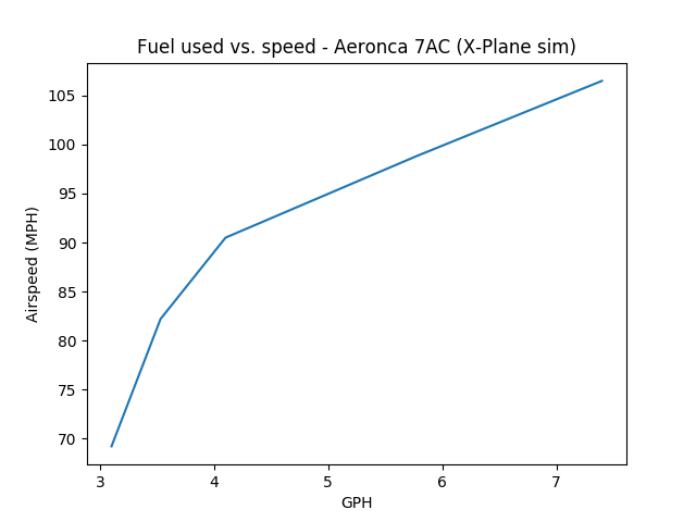

| Fuel flow (GPH) | Airspeed (MPH) | Miles per gallon |
|---|---|---|
| 7.4 | 106.5 | 14.4 |
| 5.77 | 98.8 | 17.1 |
| 4.1 | 90.5 | 22.0 |
| 3.53 | 82.2 | 23.3 |
| 3.1 | 69.2 | 22.3 |
This data was generated in the X-Plane simulator flying a mostly-accurate Aeronca 7AC model someone made available on the x-plane.org download site. To gather it, I flew at different throttle settings, stabilized the plane so it was flying level, and recorded fuel flow and indicated airspeed. Much easier to do this in the simulator than in real life -- I don't have a fuel-flow meter in real life!
Obviously, this is not Hard Science™. It's still interesting. I only gathered 5 data point over the course of about 15 minutes of flying, but it's representative of the range of speeds you might reasonably fly a Champ. The fuel flow numbers are at least similar to what I would expect in reality, though the RPM indicated for a given fuel flow is substantially high compared to what I see in my own plane.

The Champ instrument panel in X-Plane
The conclusion that I see here is obvious: if you're flying a digital Champ in X-Plane, and you have the same model of 7AC I downloaded, aiming for a cruise of about 83 MPH will get you the best fuel efficiency. Pretty much squares with what I see in the real world.
It'd be neat to some day instrument the plane to duplicate this test in real-world conditions, though I doubt I will. Fuel flow meters are expensive, and somewhat counter to the feel of the Champ. If I could do it temporarily, though, that would be very interesting...
Posted at 23:04 permanent link category: /aviation
Wed, 13 Jun 2018

Back in February of last year, I got a plane. Norbert, the Champ. I was (and still am) an active member of Chapter 84 of the EAA. EAA 84 has their chapter meetings on the second Tuesday of every month. Now that I owned a plane, I really wanted to fly it to one of these meetings.
The problem is, Chapter 84 meets in Snohomish, at Harvey Field (S43), the same airport where the plane is based. It doesn't make much sense to fly the plane to its own airport. How would that even work?
It works if you're a bit crazy. Crazy like a crazy person!
It goes something like this: very early in the morning, drive up to Snohomish, conveniently going the opposite direction from all the traffic. Get in the plane, and fly it from Snohomish to Boeing Field, which is reasonably close to downtown Seattle, where I work. Take a taxi (since there is no practical bus service) to downtown. Work for the day. Leave a touch earlier than normal, and take a taxi back to the airport. Fly from Boeing Field to Harvey Field, waving slightly ironically at all the poor car commuters below me on I-5, moving through a 10 MPH continuous traffic jam. Go to the meeting. Drive home. Simple, right?
As simple as it should be, the Seattle weather and my schedule have conspired for well over a year to prevent it from happening. If I can go to the meeting, the weather is terrible. If the weather is gorgeous, I'm otherwise committed. Most vexing.
Finally, yesterday, I was able to pull off the World's Silliest Commute™. The weather was predicted to be perfectly flyable until midnight, well after I needed to fly.
I should note that I live about 6 miles from my workplace. A bike trip takes 35 minutes each way. Taking the bus takes 35-45 minutes depending on traffic.
Getting There
So, I left the house at 7 am almost on the dot. I arrived at Harvey Field without much incident 45 minutes later. There was a car fire that was out at Northgate, which slowed everyone down so they could rubberneck at the flashing lights, but that only added a minute or two to the trip. So far so good. I preflighted the plane, and was in the air by about 8:20. I shut down at Boeing Field half an hour later, at 8:49. So far, so good!
The weather was gorgeous for the flight in
I parked the plane at Kenmore Aero Services, who charged me the princely sum of $15 in "handling" to stay there for the day. Cheapest parking on the field, though, and compare that to a day of parking your car anywhere near downtown ($30+). Parking for airplanes is weird.
Anyway, I called a cab, who showed up about 9:05, and we were on our way. Unfortunately, Airport Way (the most logical path to downtown) was blocked, and we had to backtrack and take a very crowded I-5 to get there. I arrived at the office around 9:40. Fortunately my workplace is very chill about when people show up.
So, trip to work: two hours and 40 minutes. Pretty clever, eh!? Also, $15 parking, and $40 for the taxi. Also, 27 driving miles and 24 flying miles.

My plane-a-day calendar was, happily, an Aeronca Champ!
The trip back was even better.
Getting Back
The taxi ride was about twice the cost I'd been anticipating, so I was somewhat anxious to avoid having to take a taxi back. Spending another $40 wouldn't kill me, but it wasn't very appealing either. I've never signed up for Uber or Lyft, so I figured I'd check out taking a bus to close by, and then using one of the rental bikes that litter the city to make the final stretch. The buses run to the north end of the field, but then they divert down the west side, and I needed to go to the east side, which would be a long walk from the nearest stop.
I identified the route: Metro 124 goes right past, and was the obvious choice. I tried signing up for Limebike (one of the rental bike outfits), and was dismayed by the terms I ran into: the Lime app won't even show you the map unless you've got location (GPS) turned on -- which I don't normally do, since I try to limit data leakage. It appeared from the non-existent documentation (ie, how the app behaved) that I would have to load a minimum of $10 into my account, but I have no plans to use these bikes long-term. Overall, the experience left me very unhappy with how it worked, and kind of turned off from the whole idea.
I looked back at the bus route, and realized that A) I needed to go to nearly the southern extremity of the field, and B) there was a bus stop on the west side of the south end of the field. It would only be about a 20 minute walk from the bus stop to Kenmore, vs. the 45 minute walk from the north end of the field (Boeing Field's long runway is about 10,000 feet long, or nearly two miles long; the surrounding land is over 2 miles long). Sold!
So, I left the office early, at 3:45, and grabbed myself a sandwich to eat for dinner once I'd arrived. I caught the 4:03 bus, and we were off. Then we hit Georgetown, and about 20 minutes of unexpected traffic. One of the other riders complained about the slow pace, and how she was going to spend her entire day just getting home. When I finally arrived at my stop, it was 4:48, making it almost exactly a 45 minute ride.
The walk around the south end of the field and up to Kenmore's building took 20 minutes, with a slight delay while I called to get the weather briefing, staying away from the very loud traffic on Airport Way S. I reflected, as I was walking along the 9" wide path through the grass on the side of the road, how oddly happy I was -- it was delightful to be doing something so different from my normal routine, even if it was kind of weird.
Kenmore was pleasant to deal with, and I fired up the engine around 5:20. Boeing ground sent me to the long runway (Boeing Field has two runways: the 10,000 foot runway, and a 3700 foot runway; the 3700 foot runway is 3000 feet longer than I need to take off), which I found fairly delightful. The Champ is an impressive aircraft in some ways. One of them is its take-off performance: 300-400 feet on the ground under conditions like this. The weirdness of having 8000 feet in front of me (leaving from part-way down the runway, at the A10 intersection) was wonderful. I could take off and land several times in that distance.

Flying past downtown Seattle
Norbert the Champ revved up, and we were quickly off the ground, passing through 100 feet as the control tower went past on the left -- it takes off quickly, but it doesn't climb very fast, with all its drag and its small 90 HP engine. We continued straight out, flying over all the Imperial Walker-looking loading cranes on the waterfront, and past the jeweled splendor of downtown's many skyscrapers. I flew over my house in Ballard just for fun, then angled my path northeastward toward Harvey Field.
As I crossed I-5, I looked down benevolently on the poor suckers in their cars, grinding slowly northward. Normally, that's where I'd be, and the difference again delighted me. It's amazing how often the weather screws up my plans to fly to the EAA meeting.

Crossing over I-5's packed traffic
The rest of the trip was uneventful, and I dropped down to land at Harvey Field, shutting off the plane around 6:15. I quickly tucked it away in the hangar, and was to the meeting by about 6:30. Later than I'd wanted to be, but the bus trip had taken longer than I thought it would.
If you're keeping score at home, that's two and a half hours from downtown Seattle to Snohomish -- and I still had another 50ish minute drive home after the meeting.
The Final Score
On the way in to work, on a normal day:
- Distance (bicycle): 6 miles
- Time: 35 minutes
- Cost: $0
On the way in to work, yesterday:
- Distance (motorcycle): 27 miles
- Distance (airplane): 24 miles
- Distance (taxi): 10 miles
- Time: 2 hours, 40 minutes
- Cost: About $65
On the way home from work, on a normal day:
- Distance (bicycle): 6 miles
- Time: 35 minutes
- Cost: $0
On the way home from work, yesterday:
- Distance (bus): 9 miles
- Distance (airplane): 24 miles
- Distance (motorcycle): 27 miles
- Time: 3 hours, 10 minutes
- Cost: About $10
Total for the day: 121 miles in 5.8 hours: about 20 MPH average, and $0.61 per mile.
Of course, what's not calculated there is how much fun I had doing it. Aside from the patent silliness of what I was doing, I was having a good time the entire time. Even grinding through I-5 traffic in the morning in a taxi driven by a guy who spent more time looking at his phone than at the road was fun, if only in how different it was from my normal daily routine.
In short, it was a good, lightweight adventure. A thrilling change from the normal day-to-day. I'm not likely to do exactly that thing again unless I can figure out a better airport-to-downtown link, but I'm very glad I finally accomplished it after dreaming about it for so long.
Posted at 00:00 permanent link category: /aviation
Wed, 21 Mar 2018
If you like real-life adventure stories and are like me, you've probably heard of The Long Way Round, in which Ewan MacGregor and Charlie Boorman ride motorcycles from London to New York by going east instead of west.
But have you heard of the other Long Way Round? It's the story of a Pan Am Clipper crew in 1941 who found themselves caught up in world events in a way they never saw coming.
Read it here: The Long Way Round: Part 1
Posted at 09:41 permanent link category: /aviation
Tue, 02 Jan 2018
For my New Year's Day, I took advantage of surprisingly good weather, and went flying. It wasn't any kind of grand flight, just up to Bellingham and back (a bit less than an hour each way). It was a good make-up for the previous day's attempt, where we got off the ground for just long enough to make a slightly uncomfortable pattern before landing again under clouds that were much lower than they appeared to be from the ground.
On my two year-spanning days of flying, I encountered two other pilots who stand out in my mind. Unfortunately, they don't stand out for good reasons.
The first pilot is a gent with a Cessna 150. I encountered him while fuelling up my plane. He'd parked his 150 relatively far from the pump, and the ground wire reel got tangled, so that he had the wire stretched to where it just reached his tie-down bolt. We were both setting up to fuel at the same time, and he had some trouble with the card reader. Once he got that sorted out, he pulled out a length of hose, and started fueling up.
Unfortunately, he hadn't gotten the hose retraction reel to a locked position (it's one of those spring-powered reels that goes click-click-click-pause as you unwind it, and you have to stop in the middle of the clicks if you want to keep it from retracting). It started retracting as he was atop the ladder, concentrating on working the nozzle. It didn't seem profitable to let that situation continue, so I grabbed the hose and pulled it out until it locked. I didn't have the impression that he noticed.
When he started his motor, it roared to life with a lot of throttle, then he pulled it back down, and taxied off to run up. I had the impression at the time, and remarked to my passenger, that he seemed like a pilot who was badly out of practice.
I ran into this same gent the next day, and confirmed my impression. He engaged me in conversation, and mentioned that he'd wanted to fly to a nearby airport (about 15 minutes' flying time away), but couldn't, because he couldn't sort out the radios. The aiport we were at, and the airport he was flying to, are both untowered fields, which 1. have no requirement for any radio use at all (though it's a good idea) and 2. need only one frequency change if you do want to use the radios. Most aircraft radios are very simple to use, with a knob to change frequencies, and a volume control, and maybe an audio panel if you have multiple radios. The audio panels can be opaque in their operation, but the 150 has never had very complex equipment.
Based on all this, I would be surprised if he's flown with an instructor in years. That's a bit of a problem, because you're required to do a biennial flight review every two years. I can't imagine the instructor who would have signed off on a pilot who couldn't operate a radio. The requirement for a BFR is relatively buried in the rules, and there are certainly pilots who fly for decades without them, but if anything goes wrong, you can bet the FAA will hike up its eyebrows and tick a couple extra boxes on its clipboard when it finds out, and the slacking pilot will feel the sting.
If this sounds more like you than you'd like to admit, you might check out AOPA's Rusty Pilot Program. I'm all for getting back in the game. But don't endanger other people in the process.
Pilot #2 seemed much more competent, but embodies a type of pilot who gets right under my skin: the "Those laws don't apply to me" pilot. We met while (again) refuelling, and admired each others' planes. He had a similar vintage plane to my Champ, and we got to discussing lighting requirements. I had just landed to avoid flying after sunset, since my plane is not (yet) equipped with anti-collision lights, and he was obviously prepping to launch. He mentioned, "Oh, my IA [highly-qualified airplane mechanic who should theoretically know all the applicable regulations] said I don't need strobes." He explained that, because his plane was made before the 1971 anti-collision-light law mentioned in 14 CFR 91.205(c)(3), it was exempted.
This is an area of aviation law that I'm intimately familiar with, because I want to be able to fly at night, but legally can't due to this missing anti-collision light issue. There's no profit in telling someone that he's wrong, so I mentioned only that I had understood the law differently, and hoped his IA was correct. I had called the FAA district office last summer, and asked this exact question; the answer was unequivocal: no aircraft may operate after sunset without flashing anti-collision lights, period, the end. There is no grandfather clause, as there so often can be with this kind of law.
So I wish him luck in his night-flying, and hope that his position lights are enough to keep him out of trouble. I honestly have mixed feelings about this particular regulation. On the one hand, flashing lights are certainly more visible. On the other hand, they don't seem sufficiently more-visible than steady position (red/green/white) lights as to require all planes ever to have them for night flight. This opinion is certainly a bit selfish on my part, because it's going to take hundreds or thousands of dollars and a bunch of work to set my plane up with the right lights.
What I can't get behind is pilots who act as if the laws we've agreed upon shouldn't apply to them. What else doesn't apply to them? When will it impact someone else? I know we're all guilty of breaking laws on a more or less constant basis (when was the last time you drove over the speed limit, or didn't come to a complete stop at a stop sign?), so I can't get too high-n-mighty about this, but I hold pilots, including myself, to a higher standard. You have very few chances to mess things up with an airplane before the stakes become life-or-death. Why start out every flight with a deficit?
Posted at 10:40 permanent link category: /aviation
Fri, 27 Oct 2017
I decided, in the face of glaringly sunny and clear skies, that today would be a good day to burn a vacation day and go flying.
So, I got up at my usual time, but made a leisurely departure of the house, finally driving off at about 9 am. I knew that Harvey Field would be socked in with morning fog, so there was no need to rush, but also that the sooner I was there and all pre-flighted, the more quickly I could leap into the sky when the fog burned off.
Thus, I had my pre-flight inspection done by about 10:30, but the fog had other plans. I ended up spending an hour in the FBO's plush chair reading my book (nunquam non paratus -- "never unprepared" after all) while the fog slowly dissolved. At 11:30, it was just about burned off, and I made my leisurely way back to the hangar. This was the beginning of the problem.
On my way to the hangar, I pulled out my phone to check in to the FATPNW group page on Facebook, to see if anyone else was planning aerial shenanigans today that might be fun to join in on. I had been pondering a flight around the Olympic Peninsula, or up to Eastsound on Orcas Island, but hadn't made any firm plans yet. There was indeed a post right near the top: several folks were planning on meeting at the Jefferson County International Airport (0S9), also known as Port Townsend, for lunch. That sounded good to me, so I set my sights on 0S9, although I knew from the start I couldn't possibly be there at noon. It was already 11:45 by the time I pulled the airplane out of the hangar, and I still needed to get fuel. So much for getting the preflight done early.
I taxied over to the fuel pump and added 10 gallons to the tanks. I had 9 already on board, and with the extra 10, I would have a guaranteed ~2 hours of fuel that I knew I'd just pumped in, plus some extra from the 9 (never take the dipstick reading at face value -- it's always off by some amount). I was trying to move quickly so I wouldn't be too late to the lunch, but I was trying for "efficient" rather than "rushed."
I didn't actually push back and fire up the motor for real until a couple minutes before noon. It would be at least half an hour's flight to Port Townsend, possibly a bit more, so I was guaranteed to be 45 minutes late after all the taxi, run-up, travel, and tie-down once I'd arrived. Even so, I was trying to keep efficient, since it would at least be nice to say hello in passing.
The run-up was normal, though the engine was a little off for the take-off and climb out. Not enough to cause me worry, and it picked up to normal once it warmed up a little bit more. I got myself cleared over Paine Field, then called up Seattle Approach to get flight following, and have some extra eyes on my sky.
The transit and landing were normal and unremarkable. I tied down, and had a good lunch, packed into a stool at the crowded bar. I wasn't the only one who thought skipping out on work to go flying would make for good lunch plans.
I got myself back out to the plane, belly pleasantly full of sandwich and marionberry pie, and started through the preflight: fuel on, check fuel drains for water, dipstick into the tanks to check level... Wait a minute. The right tank was normal, but when I got to the left tank, there was no gas cap.
This is approximately a Level 4 Oh Shit moment, on a scale of 10. Missing gas cap is embarrassing, because it means I was more rushed than I thought when I fueled up back at Harvey. But it also means (I confirmed a few minutes later on my walk-around) that the low pressure on top of the wing was sucking fuel out of the tank and scattering it to the wind, coincidentally leaving some tell-tale marks on the tail that confirmed the story. It also also means that, somewhere at Harvey Field, hopefully, hopefully, fingers crossed, nowhere near the runway, there was a ¼ pound piece of metal and rubber on the ground, ready to be kicked up by some passing airplane and potentially do some real damage.
So, this was bad juju. I was embarrassed, and scared, mostly because I was worried I'd dropped it where someone else was going to run it over at high speed, which conjured up all kinds of bad images in my head. I dipped the tank, and I still had 14 gallons between the two tanks, so I didn't lose too much fuel on the flight over. Maybe 2-3 gallons. Annoying, but not world-ending.
I had to find something to cover the tank opening with, but that was easily done by approaching the first mechanic I could find and begging a ziptie so I could fasten a nitrile glove over the opening for the flight home. Not terribly practical for everyday use, but enough to fly home safely.
No issues getting back to Harvey, and the instant I had the plane back in the hangar, I went for a walk to find the missing cap. I started by the fuel pump, hoping it just dropped there, which would be fairly safe. No luck. I asked the fuel truck guy, who happened to be driving by, if he'd seen a fuel cap on the ground, but he hadn't. I disconsolately walked along the taxiway, scanning as I went, distantly thankful that there wasn't more traffic trying to use the path. I did a full search grid over the run-up area, figuring that if it had miraculously ridden the wing all the way there, that's where it would be blown off, but no luck. I walked the entire length of the runway, where I located and removed a very sharp stainless steel #10 sheetmetal screw, but no sign of my gas cap.
I realized, as I was halfway down the runway (walking well off to the side, and constantly scanning for aircraft traffic, I'm not always a complete dummy) that I should check in to the maintenance office, on the off chance someone spotted it and turned it in. As I got to the north end of the runway, and turned toward the skydiving area, one of the skydiving folks walked toward me with that purposeful stride that says, "I'm going to challenge your right to be where you are." I quickly explained my situation, and she relented, telling me the tale of a dog-walker she encountered once, who nonchalantly walked his dog across the runway without apparently being aware of what he was doing.
I stopped in to the maintenance office, and before I could say anything, the woman behind the counter said, "Oh Ian, did you get my voicemail?" I gave her a dumb look and said, "Voicemail?" "Yeah," she responded, "someone turned in this gas cap and we thought it might belong to your plane..."
So, I was saved from the worst consequence of someone hitting my gas cap at high speed and causing real damage. I'm glad it fell off right at the gas pump like I'd first expected, and that it was quickly removed to safety. I'm glad I didn't have to rummage around for the spare gas cap that lives somewhere in the hangar.
I decided that I need to find a better place to stick the cap when I take it off to add fuel. I have two choices lined up to try out: one on the engine cowling, so that it will be obvious from the cockpit, and the other in my pocket, so that at least if I forget it, it won't cause anyone else any problems (and I can put it back on when I realize my mistake). I like the cowling idea better, but between the two I'm likely to have a good solution.
It occurred to me as I was walking the airport with my eyes down to the ground that I was lucky in another way: if I'd made the same mistake when intending to fly around the Olympic Peninsula, it could have easily killed me. Extrapolating from the actual fuel consumed on my trip to Jefferson County, I was losing about 4 gallons per hour extra from the tank. Presumably it would go faster if it was fuller, and slow down as it emptied out, but let's call it 4 gallons per hour on average. This plane only uses about 5-6 gallons per hour in normal operation, so I would nearly double my fuel consumption and be completely unaware of it. If I planned on having 4 hours of fuel on board, I would be in for a rude shock at about the 2 hour mark. The plane still glides with the engine off, and I tend to fly high, so I'd have some altitude to spend. But the peninsula is not full of friendly places to land, and my embarrassing error could easily have turned into a fatal one.
So, ultimately, I must both thank and curse FATPNW: without it, I probably would have felt less rushed, but I also would have been in for a longer flight (the path to Orcas is about twice as long as that to Jefferson County). I'm very glad it worked out the way it did, but I've clearly got some reforms to make in my refuelling practices.
Posted at 23:46 permanent link category: /aviation
Mon, 09 Oct 2017
I took the opportunity last Sunday to enjoy the sunny weather from aloft, and went flying in Norbert the Champ.
I put the dipstick in the tanks, and decided that I had about 12 gallons of fuel. Plenty for the ~1 hour flight I had in mind, and it would put me in reasonable territory to drain the tanks and re-calibrate the dipstick, which had seemed a little off when I was trying to work out the math between fill-ups and gallons per hour on recent trips.
The flight went as planned, and I set up in the hangar to drain the fuel from the tanks, eventually (holy buckets does it take a long time to drain a fuel tank by the sump drain) getting about 4 gallons out of the two tanks. Given that I had just flown 1.4 hours at ~4 gph, that already suggested I was on the right track: I should have had about 6 gallons left, not 4.
The tools I had at my disposal were two 6-gallon jugs, and a "2 gallon" jug, which I decided would be my measuring container. It turned out, half way through, that it's actually a "2 gallons and 8 ounces" jug, intended for mixing 2-stroke oil with gasoline, so my measurements were on the imprecise side. I also had the magic hydrophobic funnel, which allows me to do all this fuel pouring without transferring water or other crud.
The fuel system on the Champ is very simple: two 13 gallon tanks reside in the wings, and are connected together above the fuel shutoff valve. This means that they (very slowly) cross-feed at all times, so any fuel additions would have to be to both tanks before taking a reading, to ensure I wasn't seeing one tank slowly creep up the level of the other.
The plan was this (and it worked reasonably well): go to the pumps and fill the two 6-gallon jugs with exactly 10 gallons of fuel, 5 per jug. Fill the 2-gallon jug twice, and fill each tank on the plane with 2 gallons of fuel. Dip the tanks, and mark where the fuel hit, having previously erased the old marks. Lather rinse repeat until the 10 gallons are in the tanks, then go fill the two 6-gallon jugs again and repeat the whole process.
Since I started this exercise with about four gallons of fuel, I first poured this amount into the tanks, and got my first surprise. The right tank registered about an inch of fuel on the stick. 2 gallons, marked and done. The left tank left the stick completely dry. No 2 gallon mark. (The landing gear on the left is always extended slightly further than the gear on the right, so that the left wing is several inches further from the ground at rest.)
Keep going: 4 gallon marks for each tank -- one side of the dipstick is marked RT, and one is marked LFT, but previously, the levels had been exactly the same on each side; don't ask me why there were two sides before. Interestingly, the 4 gallon mark for the left side was only about 4mm below the 4 gallon mark for the right side, suggesting that at 2 gallons, the left tank was just barely shy of hitting the stick.
So I kept going, marking 2, 4, and 6 gallons, then marking 7 when I split the final 2-gallon jug between the two tanks. I went back to the pump, and refilled with another 10 gallons, figuring I was already half-way there, so I might as well finish the job. Marked 9, then 11 gallons, although the right tank overfilled and spilled down the wing by some amount, so the final count was not terribly accurate. Presumably, the tilted wings mean that it would be possible to fill the right tank so far that it comes out the vent, when filling the left tank to the very top.
In all, I put in around 24 gallons of fuel (exactly 20 from the pumps, and about 4 that had already been there, minus the overfill), and completely filled the right tank, while the left tank got near the filler neck but didn't quite touch it. The dipstick reads about a quarter inch difference between the right and left tanks, and had been reading almost two gallons too full on the right tank, and about one gallon too full on the left.
That means I had previously thought I had half an hour more fuel than I actually did. That's a sobering error, and one that could have bitten me badly. It's a more than 10% error.
Since the 2 gallon jug was actually more than 2 gallons, and I didn't fill it to exactly the same amount each time, I'm still only going to trust the dipstick as an approximation of the fuel left in the tanks. It's a more pessimistic approximation now, though, and that suits me just fine.
Until I can redo the job with a properly calibrated filling rig, I'll live with the knowledge that I may have a little bit more fuel than the dipstick says I do, but do the math as if I don't. It's always a better surprise to find out you have more fuel than you think you do, rather than the other way around.
Posted at 21:54 permanent link category: /aviation
Sun, 24 Sep 2017
Last Christmas, I got a Stratux box as a present. This is a little Raspberry Pi tiny-computer with a couple SDR dongles attached, which will listen to aicraft traffic and show it on a tablet. But if you needed that introduction, you can definitely skip this entry, for it will go Deep Nerd on the Stratux, and be incredibly boring for you.
My particular Stratux was running version 0.8r-something (I forgot to note exactly which version it was). It worked pretty well, but on the last few flights, it started doing this thing where it would stop sending traffic to the tablet. If I pulled the power and rebooted it, it could come back for a period of time, but never for terribly long.
So, I decided I would try loading current software on it. The Stratux project is up to 1.4r2, which is a pretty substantial leap. I downloaded the upgrade script for 1.4r2, and sent it in via the Stratux web page. Once I re-joined the wifi network, all appeared to be working, so I tucked it back into the flight bag, and brought it with me for today's flight.
It all seemed to be working for the first maybe 20 minutes, but as soon as I was done with my pattern work and departed for Jefferson County to see if they had any pie left (gotta have some kind of goal, right?), I noticed I wasn't seeing traffic again.
Sighing a bit, I pulled the power and plugged it back in again, wondering if I had burnt out some part of the hardware. It wouldn't be the end of the world if I had, but how annoying. However, it didn't come back. In fact, the wifi network didn't show up again either. That was weird. Made troubleshooting harder too, since I didn't have any other way to access the Stratux than wifi.
I tried a few more times on the way to and from JeffCo, but didn't have any luck. This was just kind of piling on, since I'd already blown 40 minutes trying to retrieve a pen that mysteriously ended up in the belly fabric under the cockpit (a royal pain to deal with, and had me seriously considering whether I'd have to bring in a mechanic to solve it), and discovered that my inexpensive endoscope camera had mysteriously died between the last time I used it and today, when I really wanted it to be working, so I could locate that stupid pen. (I did ultimately get the pen out, by locating it through primitive tap-based echolocation on the fabric, then tapping it so it ended up in a spot I could reach past the baggage area.)
Anyway, discouraging to have all these things going wrong, seemingly all at once.
I brought the box home, and found some information, which I thought others might enjoy seeing as well.
The first tidbit: the green "status" light (labelled ACT on the Raspberry Pi 3) was blinking rapidly, about 5 times per second. I downloaded the source code, and found where that gets set. Unhelpfully, it does that any time the Stratux software encouters a "critical error." Not terribly specific, but I knew at least that the software was still running, though it had croaked in some fairly fundamental way.
The next tidbit: I found this bug report suggesting that other people are having a similar problem. Specifically, they saw the flashing green light, and the lack of wifi, and they were using the same 1.4r2 version that I was. One mentioned that downgrading to the older 1.2.r2 version worked correctly, so I decided I'd try that.
Since I'd upgraded the system, and it had knocked the wifi offline, the only way I could do anything with it would be to reload the SD card. So I found the Stratux release page, and located the 1.2r2 release image. Next, I had to figure out how the Stratux folks want you to blow an image onto the SD card, so it was off to the Raspberry Pi documentation page to figure it out. They want you to use some new graphical tool, but I'm sufficiently oldschool that I just wanted the dd command line. Fortunately, they have it, couched in a whole lot of "You don't know anything about Linux, so..." exposition, but they have it. I dd'd the image file onto the SD card, and have now had it running for just over 50 minutes, without apparent issues.
So, two out of three things were salvaged today: I got that stupid pen out of the belly (and it will always live in its elastic loop on the kneeboard from now on), and I got the Stratux box back into something approaching serviceable order. The endoscope continues to show a black image though, so that may be the end of that. Fortunately, it's one of the $15 variety, so it's not a huge financial hit to replace it. It was more the frustration of having a tool, needing to use it, and it not working like it should when I needed it.
An hour and 6 minutes in, and we're still showing traffic, so I'll call the Stratux upgrade/downgrade a success.
Posted at 21:18 permanent link category: /aviation
Tue, 22 Aug 2017
The Final Episode: From Ashland to Seattle

My "campsite" in the dawn light
Previously: Can a Champ really fly from LA to Ashland in one day?
I awoke on Friday morning ready to face the day's flying. As usual, I woke up as the sky showed the sun's progress toward our horizon. The placement of the airplane between myself and the sources of light worked well, and my sleep that night had been a bit more restful than previous nights in the tent. It wasn't as if I was sleeping in my own bed, but I had at least gotten the temperature right, and didn't wake up as many times in the night.
In my planning for the flight back, I had looked at the flight from Ashland (S03), and reconsidered my fuel stop. On the way down, Roseburg (RBG) had made sense to give myself two-hour legs headed south, but it left me with only an hour and a half necessary to reach Ashland. I wanted to start the day with a longer flight, so I had filed the flight plan to Eugene (EUG), an additional 60 miles beyond Roseburg.
A flight plan for my kind of flying is an interesting beast. Its main purpose in life is to have someone else there to check in on you. It is effectively declaring, "I will fly from XYZ to ABC, leaving at this hour, and taking this long to do it." When you take off, you call up the local Flight Services station on the radio, and ask to activate your flight plan, giving the actual departure time if it's different from what you planned.
The plan is opened, and practically speaking, nothing further happens until you either close the plan, or the time enroute expires. If the time expires, they have an escalation policy, that goes something like:
- Call the pilot
- Call the alternate contact
- Call the destination airport
- Talk to ATC
- Scramble Search and Rescue
If the first step doesn't yield any results, they move on to the next step, trying to locate the pilot who is now overdue. They keep moving up the steps until they find you, dead or alive.
Usually, I'm pretty good about remembering to give them a call either on the radio shortly before I land (wherever I land is inevitably outside radio range once I'm on the ground), or on the phone shortly after I land. On the one occasion this trip where I forgot to call and close my flight plan, I got a call within about a minute of the planned arrival time, and I sheepishly said that yes, I was down safely, and apologized for not closing the plan.
The cool thing is, it's really quite effective. If I were to have a problem enroute, I have a double safety: I'm talking to Air Traffic Control to have them watch out for traffic that might get too close, and I've got the Flight Service folks who will trigger escalating searches for me if I don't show up at the planned time.
ATC, being in contact with me, is very likely to get a call from me saying something's wrong, if something goes wrong. I carry a spare, battery-powered radio specifically to cover the case of a full electrical system failure. Even if they don't get a radio call from me, I've told them where I'm headed, and if they see me suddenly descend or go wildly off-track, they'll call me trying to figure out what's going on. If they can't reach me and I drop off the radar, they note where I dropped off, how fast I was going (both laterally and vertically) and what direction I was headed. They now have a very good idea where to send the SAR folks.
If, for some reason, ATC doesn't notice me drop out of the system, Flight Services will start ringing bells when I go overdue. All the radar information and radio calls are recorded for later review, or to assist with a search operation. By having myself logged in to the system to use VFR flight-following (which is the term for this kind of casual ATC contact), they will specifically track my plane, and can identify it on the radar screen at all times.

Heading out of Ashland, toward Medford
In any case, I had filed the first flight plan of the day for Ashland to Eugene. It would be something like two and a half hours, but I had discovered that I could withstand 3 hours in the plane at a time. My estimation of which was the biggest problem with the pilot's throne in Norbert vacillated between the coccyx-bending seat cushion and the lock-kneed rudder pressure, but as time went on, the tailbone pressure was winning the award for Most Annoying.
I don't know if you've experienced continuous, unshifting pressure on your tailbone for any real length of time, but if you haven't, take it from me that it is a literal and very real pain in the butt.
I had decided that for this leg, I would not take the shortcut over the mountains that I had taken on the way down, direct between Medford and Roseburg, skipping Grant's Pass (3S8). I wasn't pressed for time now, and preferred to keep the big safety net of I-5 under me.
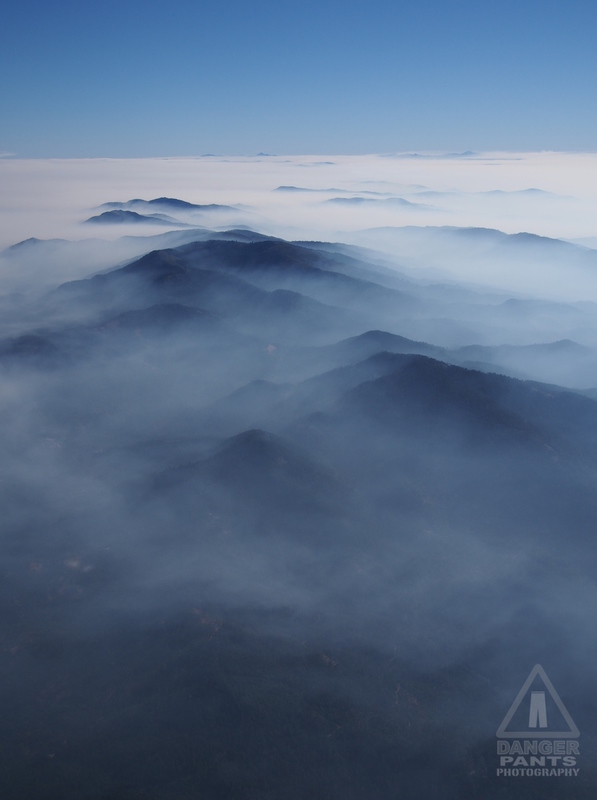
Mountains peeking above the smoke
I'm very glad I followed my planned path. I ended up seeing the most ridiculously beautiful smoke + mountain vistas. The pictures don't really do the sight justice, but I'll see if I can do a bit of post-processing later to bring out what I was seeing from my fabric-covered cockpit.

Smoke swirls across the landscape like water flowing in a stream
The smoke cleared as I hit Roseburg, and I was treated to the sight of my previous fuel stop from 8500 feet in the air.
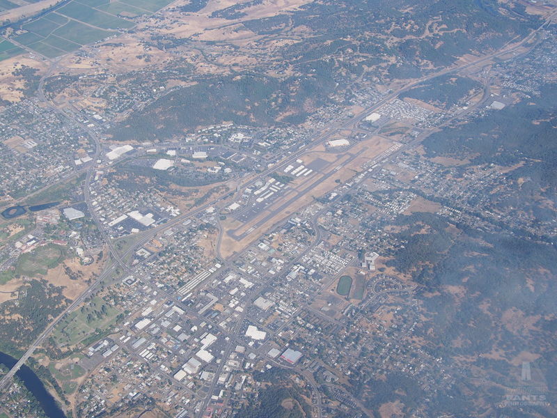
Roseburg (RBG) from above. North is to the upper-right.
The hills that housed Roseburg gradually smoothed out, and turned into foothills, which turned into ripples, followed by plowed fields, until I was looking down runway 34R at EUG. ATC directed me to make a straight-in landing to runway 34R, which makes my longest-ever straight-in approach, of something like 30 miles.
The amount of time it took to actually descend and reach the runway was kind of comical. I was still going the same ~85 MPH as I'd ever gone, but it was like one of those uncomfortable sketch comedy routines where it just keeps going and going. It goes from funny to annoying to boring to really annoying to funny again. I could only imagine the poor controllers in the Eugene tower were looking pointedly at their watches, kindling a fire on the exterior platform and pointedly roasting marshmallows, pointedly spawning new generations of controllers, and generally making a big deal out of how very slowly I was moving. Not really, but it was fun to think about.
I got clearance from the tower to land on 34R pretty early on, maybe 8 miles out. It really was ridiculous how long it took me to actually arrive and land.
I did finally touch tires to tarmac, and after a minor miscommunication with the ground controller, got myself taxied over to the self-serve fuel. There was a lovely Fairchild high-wing monoplane just taxiing away as I pulled up, and I gave them an enthusiastic thumbs-up out the window. It took me 2.5 hours from Ashland to Eugene, and obviously most of that was the approach to landing. I had departed Ashland at 8:40, and shut down in front of the fuel tanks in Eugene a few minutes before 11. (If the math seems a bit off, I had started the motor ten minutes before I departed Ashland, and the official 2.5 hour time is motor-start to motor-shutdown.)
Eugene was a brief stop, and I was quickly back in the air and headed for Scappoose (SPB). I had briefly toyed with the idea of stopping in Salem for lunch, but I really wasn't feeling hungry, so I decided to stick to the original plan. As I flew past Salem, I was glad I'd kept to the plan, since it appeared too quickly after I'd taken off, so that I would have felt like I'd flown too short a leg.
The flight to Scappoose was unremarkable, until Seattle Center handed me off to Portland Approach. Portland was apparently busy that afternoon, and I was shuffled past Hillsboro (HIO), and commanded to "Maintain VFR flight at or below 4000 feet." Normally they give a nice "Descend and maintain" instruction, but this was like a gym teacher saying, "Drop and give me 20!" I lost altitude from 6500 as quickly as I figured was prudent, directly over the Hillsboro airport. There was a mass of dots on my traffic display over Hillsboro, but I figured 4000 feet would still be well clear of them.
Finally I was given the instruction to resume my own navigation, and I continued over the ridge toward Scappoose, one eye tracking an airplane 1500 feet below me that was zigzagging around directly below my flight path.
Scappoose was also experiencing an aerial festival of some sort, and I counted at least four aircraft calling positions in the traffic pattern over the airport. I found my way behind a twin, and followed him in to land, glad that we were landing to the north, so that my taxi to fuel wouldn't take as long.

Norbert with Dave Baxter and son's Stardusters
I noticed as I taxied in that there were temporary-looking signs declaring a ground control frequency. Then I noticed a blue biplane crossing the runway, and called on the radio to see if it was who I thought it was. Yep: Dave Baxter, unofficial head honcho of the Starduster Too fanclub. That made two unofficial biplane head honchos I'd run into on this trip.
I gassed up, and chatted with another pilot in line for fuel, who had a slightly cartoonish looking composite Light Sport plane (I wish I'd taken a picture), which he said flew 150 knots or something ridiculously fast like that, using a Rotax 912, which is more or less the same engine as in Norbert (note to airplane people: I know, I know -- I'm writing this for everyone though, not just aviation nerds). It was hard to believe it was so much faster on just 10 HP more.
While I was there, I bought another quart of oil at the FBO, even though the oil level in my engine hadn't reached an uncomfortably low level. I wanted to check my hypothesis that the oil temperature on climb would be lower with more oil in the tank.
Then I taxied over and parked Norbert next to Dave's Stardusters to say hello. I flew with Dave last year, when he very kindly took me up for an hour of Starduster time, which was also my first time in an open-cockpit biplane. We chatted for a bit, and he ran off to get me some spare temper foam he had lying around, to see if it would help with my increasingly uncomfortable seat.
I had to excuse myself again as I had with Glenn and Judi in Placerville, since I wanted to continue on. I felt bad, because Norbert was a logical addition to the vintage aircraft fly-in they were having. It would have been interesting to stay and see what other cool vintage planes showed up, but I knew I had hungry kitties at home who would be sad if I didn't feed them.

Headed toward Kelso and some friendly puffy clouds
My parents' house is in Scappoose, and I debated flying over it to make sure it was still standing, but decided I needed to make forward progress rather than lollygagging around. I continued my climb toward Kelso (KLS), oddly pleased to see a layer of puffy clouds -- I was finally back to weather conditions that made sense to my Northwest-raised brain. I had initially thought to fly this leg at 6500 feet, but ended up climbing further for 8500 when I saw that the clouds topped at around 5000 (technically I only need 1000 feet over the tops of the clouds to be legal, but legal and comfortable are different things).
I noticed as I climbed that the oil temperature was indeed a bit lower. The highest temperature I'd noticed in climb was about 215° F, climbing out of Bakersfield to cross the Grapevine, with 3.9 quarts in the engine. The climb to Kelso was with 5 quarts, and the temperature only reached about 195°. Just flying around Seattle, the highest I'd previously seen was about 180°.
Around Chehalis (CLS), I started to worry that the clouds were bunching up, and that I might have trouble finding a hole to get through further along. There was a handy break in the clouds just under me, so I called ATC and told them I'd be "maneuvering" to get below the cloud deck. If you count a more than 90° turn and droppling like a rock through the hole as "maneuvering."
I found myself now flying at 3200 feet over the rolling hills of central Washington, and the flight had gone from perfectly smooth to rough and tumble as the wind rolled over the hills and took me on the rollercoaster with it. I aimed for Olympia Regional (OLM) to avoid some military airspace that chatter on the frequency had suggested to me might be active. I reached calmer air as I got over the water south of Tacoma Narrows (TIW).
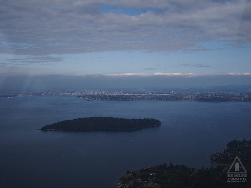
Seattle in the distance, beyond Blake Island
Now in the home stretch and on my home turf, I cruised up the Kitsap Peninsula, over Winslow on Bainbridge Island, and crossed the water to get a picture of my house in Ballard, then diagonal up to Harvey Field.
While I was looking for my house in Ballard, the controller called me up, and mentioned that I was 200 feet below the approach path of a major turbojet route. Alarmed, I asked him if I needed to change where I was flying, and he clarified: he was commending me for using flight following in the area, and said they were trying to advertise to pilots that they should do this around Boeing Field (BFI). I concurred heartily and assured him that I was usually talking to ATC if I was flying here (which is true). He voiced his pleasure at hearing this. It was an interesting exchange, because I frequently think of requesting flight following in the Seattle area as being a burden on controllers rather than something they want to be doing.
He cut me loose as I crossed the north end of Lake Washington after warning about a business jet crossing my path 500 feet above (quickly spotted, unlike most of the traffic that ATC calls out for me). I made my descent over the ridge, called a few position reports, lined up for a longish base leg into runway 33R at Harvey Field (S43), and was quickly on the ground and rolling for my hangar after a pleasantly smooth landing.

Norbert safely tucked into its hangar
Groaning a bit with the exhaustion of flying 15.7 hours in two days, I heaved myself out of the cockpit, and slowly unpacked the plane. I repacked all my stuff into the car. I did the post-flight tasks. I didn't really want it to be over, but it was time to go home.
I accomplished my goals for the trip: I flew to LA in a 1956 Champion 7EC; my flight planning was sufficiently good that I was opening all my flight plans within half an hour of expected departure; I got to fly with my brother; I got to visit a Marquart Charger and go for a short flight. Even the weather had mostly cooperated (though I would have accepted less overcast at the start, and less heat through central California).
There are no profound lessons to be learned from this flight. Or, if there are, they'll come to me over the next year or two. There are some mundane lessons, like, "Remember to check the winds aloft," or "Find a better seat cushion," or "It is possible to pack that much stuff safely into Norbert's baggage areas." Even, "Yes, it really doesn't go any faster than a slightly speeding car, but at least you can fly in a straightish line."
Returning to work this week has been a little bit of a let-down. I'd rather (as the license plate frames say) be flying.
Posted at 23:30 permanent link category: /aviation
Mon, 21 Aug 2017
Seattle to LA and Back, Episode 4: Can a Champ Really Fly from LA to Ashland in One Day?
Previously: Tulare to LA, and Flying with David
Aside from a somewhat dodgy choice of hotels (maybe avoid the Travelodge Pasadena Central -- it's cheap, but it's also cheap), my stay in LA was pretty cool. David and Tara, his wife, were fun to hang out with, and in addition to getting to spend time with them, we also went to the California Science Center, which was one of the tiny handful of museums which received a Space Shuttle when the shuttle program was decommissioned. It was very cool to see the shuttle in person. The trip was well worth it even if that's all I'd done. I was still eagerly drinking it all in as the closing hour drew nigh, though my companions were nearing done with artifacts of the space program.
On the flight down, I'd found myself squinting uncomfortably into the sun as I flew south, and had finally grokked what ball caps were good for: my full-brim sun hat, though effective and good for most things, simply wouldn't fit under the headset. I figured a NASA baseball cap would be the closest I'd ever get to actually wanting to wear one, so I grabbed just such an item from the Space Shuttle Endeavor gift shop, exclusively for use while flying.
It was odd saying farewell so far before my actual departure, but the timing of things meant that I said goodbye to Tara shortly after dinner on my departure eve, and David and I said goodbye around 10 that night. They both had work in the morning, and the directions everyone was driving meant that it was far more sensible for me to take a taxi to the airport than any other choice.
So, I prepped that night and got everything as ready as I could. David and I had stopped by the Vons supermarket earlier in the night and I'd picked up my flight snacks. We also made a trip to Sprouts, which seems to be the LA equivalent of the Puget Consumer's Coop, so I could get slightly less terrible candy-style snacks than Vons carried.
My plan was to try to launch by 9 am the next morning. I figured that would mean about half an hour of getting to the airport, and at least 45 minutes of packing, preflighting the plane, getting fuel aboard, paying bills with Billion Air Aviation (everything's bigger in LA: I'd passed several Million Air Aviation FBOs already on the trip, but LA just had to one-up them), etc. So I called the taxi for 7:30 am on Thursday.
As expected, I was awake before the alarm went off (I never sleep very well when I know I have an early alarm, probably out of anxiety I'll oversleep and miss it), and went down to check out the breakfast offered as part of my room price at the Travelodge. It was better than I'd expected, and I had a waffle from the waffleautomat and half of an indifferent bagel with cream cheese from a little blister pack, along with a nearly ripe banana. I found I wasn't very hungry though, being somewhat anxious about my day's itinerary.

Norbert was alert and ready to go
The weather was as close to perfect as I could have asked for. The previous days I'd been aware of had all had a heavy marine overcast layer in the morning that wouldn't burn off until almost midday, but on this day, it was bright and clear (for LA) when I checked upon waking. Good thing, too, because the flight plans I'd filed had outlined that I needed to make an early launch if I wanted to actually reach Ashland by sunset.
As it happened, things continued well as I went to the airport. I got a friendly, chatty cab driver, and we spent the whole ride discussing engines, airplanes, cars, racing, motorcycles, and more engines. After he dropped me off, he asked if he could come see the plane, so I took him back and showed him Norbert, with its very simple instrument panel, and the engine, which is really just an overgrown VW Bug engine. The Continental C90 under Norbert's engine cowl, which produces 90 HP, displaces about 200 cubic inches, or almost 3.3 liters, vs. the last generation Bug engine, which produces about 65 HP from 1.6 liters. The Beetle engine gets to turn twice as fast as the Continental, though, since the Conti is limited to 2500 RPM.

Residential Pasadena, looking westish, with the Rose Bowl just visible in the distance
The fuel truck rolled quickly, and I got the plane packed faster than I'd expected, so that I found myself starting the engine at 8:42, and starting my enthusiastic trundle down the runway at 8:51, a full nine minutes ahead of schedule. Norbert eased off terra firma, gained a bit of speed, and we proceeded confidently into the LA permasmog. Of course, the air was perfectly smooth, and I thought wistfully of David, even now on his way to his office. Hindsight, as he commented a couple text messages later, is 20/20.
In the comparatively cool morning air, we climbed with admirable speed, and it didn't take long before I was passing the Burbank airspace and climbing for my mountain-traversing 8500 feet. The mountains didn't seem so daunting as I flew northbound, mostly because they were no longer Terra Incognita for me.

Mountains receding to the east, toward the Mojave Desert
The trip back, like most trips back, seemed to take much less time than the trip down had. There's something in our psychological makeup that makes it much simpler to retrace footsteps in reverse than it is to follow that path the first time. Of course, it took a similar amount of time, but it seemed to go by much quicker. I also finished the bulk of Ruby 2 as I traversed the San Joaquin valley, which may have contributed to the effect.

Flying past Burbank and headed into the mountains, making good time in favorable wind
I noticed, while I was in LA, that I had a weird itchy spot on my left leg. I couldn't remember if I'd scratched myself there and perhaps it was getting infected, or quite what could have caused it. It was sort of a low-grade rash, but there was something familiar about it. Right above the knee, and it certainly felt like an allergic reaction.
My first stop was Porterville (PTV), which had been a planned stop on the way down. It had the cheapest fuel in the area, but was otherwise unremarkable, at least in my mental state as I was passing through. When I unstrapped the kneeboard from my left leg, I suddenly realized what must have caused the rash. I turned the kneeboard over, and sure enough, it was bright shiny metal right where it had been resting on the rash. Well, it used to be bright shiny metal. It was nickel, and I inadvertently confirmed that I am still allergic to nickel (a process which quickly corrodes and renders dull whatever nickel I'm in contact with). I filled the tanks, and continued on, stopping only 20 minutes on the ground. I departed from Porterville at 11:15 am, and aimed myself at Tracy (TCY), another cheapest-fuel-in-the-area airport. A washcloth was laid carefully under the kneeboard to prevent further nickel contact.
The trip to Tracy (which I chose for scenic variety as much as anything else, though it didn't end up being terribly different from other airports in the valley) was remarkable for one reason: I spotted and reported a fire that had apparently not yet been reported. I'd heard some discussion of reporting fires to ATC in the weeks before my trip, particularly with the wildfire smoke sweeping down into Seattle, and I wondered at the time if I'd have occasion to do such a thing. The possibility seemed remote.

A fire burning in a field near Merced Regional (MCE)
Yet here I was. I called up the controller and asked if they'd had a fire reported near my position. She didn't think so, and asked a few detail questions: could I tell what was burning? What was the exact location? I answered as best I could -- I initially thought I was approaching a couple of low-lying clouds, which seemed weird. It took about five minutes of approaching the clouds before I realized they must be smoke, and I started looking for the source. Finally I saw it, and reported back that it was a field burning, about 2 miles off my right wing, bordered by a canal to the north. She thanked me, and presumably sent off a report to regional fire authorities.
The remainder of the flight to Tracy was unremarkable, though it was on the western edge of the valley; if I had kept flying west, I would have crossed the hills into the Bay Area. As I descended, it became clear that there were a number of people flying around the airport, and it took me a little bit to figure out how to insert myself safely into the traffic pattern.
Once I was in, I was following a Cessna a little bit too closely, banking on Norbert's relatively glacial speed to get us a little bit of separation. Fortunately, my plan worked, and it was aided when the Cessna made an uncomfortable-looking touchdown, thought better of it, and goosed it to go around and try that landing again. I asked over the radio if he'd run into a crosswind (gusting crosswinds are kind of a nightmare in a taildragger like Norbert, and I'd never really dealt with one before, so I was a little worried), and he gave me a one-syllable answer that I couldn't interpret. Another voice came on the radio and said, "Yeah, there's a bit of a crosswind down here." I thanked her, and determined to do my best.
As it happened, I needn't have worried. There was indeed a crosswind, but it wasn't very strong, and at least for my landing, was pretty steady. I got the plane on the ground with a minimum of squealing tires and bounces -- the oleo gear in the Champ really does make non-bouncing arrivals easier than they should be -- and taxied to the fuel tank.
It was 1:30 when I shut down the engine, and I decided I should probably eat my lunch at Tracy. After a moment of panic that I'd broken the fueling protocol when I forgot to press the START button (which apparently reset the counters), a guy in an official-looking truck pulled up, and we looked helplessly at the squat industrial boxes as he explained that the person who actually knew the system was out. Then, minutes after I thought it should have happened, the self-serve console beeped and printed out my receipt. It listed the correct amount, about 11 gallons. We both heaved a sigh of relief. I asked him about bathrooms, and he pointed to a trailer with PUBLIC RESTROOMS printed on it in big bold letters, and when asked about lunching shelters, pointed to a covered picnic table. Good enough for me. I had my supermarket lunch of bread and cheese and a brownie as I listened to the ravens cawing at each other from lamppost to fence. The trailer bathrooms were, miracle of miracles, air conditioned and pleasantly cool.

A cool construction that gave every house waterfront access
Norbert's tires lost contact with Tracy's runway at 2:45 pm, and I aimed our path towards Willows (WLW), where I'd stopped on the way down. The path was quite different, coming from Tracy as I was, and I found myself flying over a fascinating series of canals and waterways, including the one pictured above, which seemed to provide a large number of houses, each with its own dock jutting out into the water. The water around the houses was connected to all these canals and waterways, which seemed to stretch in a network for miles and miles.
Eventually, I left the waterways behind me, as I listened to Ruby 1 ripping the jacket off Rodant Kapoor, button by button and piece by piece, as he emceed a concert on live holovision, to his complete spluttering displeasure. It was understandable: poor Ruby had been attacked by the Slimeys, genetically engineered assassins, and one of them said Rodant had hired them. What a pickle for poor Rodant, framed by Horace Wimpy!
Willows was just as I had left it. As I came in, a Cherokee coming from the southeast tried to sneak in front of me, but gave up when he realized we were trying to land on conflicting runways, and he hadn't spotted me yet. I didn't have him in sight either, but I had him on the traffic display, and after we'd both landed he came up to ask what I was using that had allowed me to see his location. I showed him my tablet and Stratux box. He admitted to feeling a bit rusty, and I congratulated him on not landing on runway 31 like he'd been planning on, since it would have been a 5+ knot downwind landing (downwind landings can dramatically increase landing distance, and it's pretty easy to run off the end of the runway doing them; pilots who want to have long flying carers avoid downwind landings if at all possible). When I departed Willows shortly thereafter, I chose runway 13, the opposite direction of 31, as the one best aligned with the wind.
I launched from Willows as quickly as possible, mostly because it was still beastly hot: 35° C, 95° F. In fact, we left the ground at 5:10 pm to fly our final leg of the day, to Ashland. Since the planned flight time was only a bit over two and a half hours, I felt confident we would be able to make it before sunset. Surprised it had all worked so well, but confident nonetheless.

Mt. Shasta with considerably less smoke obscuring its flanks
The flight to Ashland was livened up by a call from air traffic control as I was passing Mt. Shasta: there was a much faster plane behind me, on exactly the same path (a logical rubber-band-line between airports). He asked me to divert, and I found myself briefly aimed straight west instead of the north I had been going. I finally spotted the plane as it passed me by, a thousand feet below off my right wing and, indeed, going much faster. In the monocular, it looked like it might be a Cherokee, although your basic Cherokee isn't that much faster than the Champ.
Air traffic control lost radar contact with me as I descended toward the Ashland airport (as expected), and let me loose to fend for myself. I had a moment where my brain couldn't make sense of the scene in front of me before it snapped into mental focus, and I saw that the Ashland airport was still behind a hill. I thanked them (as always) for their help, and landed at Ashland a whole fifteen minutes before sunset. I felt like I was losing my razors-edge timing.

Sunset as seen over Norbert's nose
I fueled up and picked a spot far from the sodium lights, strategically placing Norbert between tent and rotating beacon for the night. It was a better setup than the first time through.
As I ate my dinner at Skinner Aviation's picnic table, a gent walked by with his dog, and we ended up chatting for an hour. He had spent many years living in Ballard, the same neighborhood I live in now, and we discovered that we're both theater folks, he being employed working in the scene shop for the Ashland Shakespeare Festival. It was a delightful end to a long but fulfilling day of flying my plane from Los Angeles to Ashland.
And now I've broken the rule of internet articles which ask a question as their headline, by answering "yes:" a Champ can, in fact, fly from LA to Ashland in one day.
Next: Ashland to Snohomish and Home Again
Posted at 23:27 permanent link category: /aviation
Sun, 20 Aug 2017
Seattle to LA, Episode 3: Over the Grapevine and Flying with David

The crop duster takes on his 500 gallons(!) of pesticide while Norbert wakes up
Previously: Flying from Ashland to Tulare, and flying a biplane
The Grapevine (as I understood it at the time -- research now suggests I've got the wrong name) is a range of mountains that stretches roughly east-west north of Los Angeles. As I chatted with the crop duster pilot that already-hot morning at Mefford Field in Tulare, CA, he casually mentioned, "Are you worried about going over the Grapevine?"
Well, I hadn't been, until he mentioned it.
I had, as expected, slept poorly at Mefford Field. Between the heat and the freeway noise (somewhat attenuated by wearing earplugs, but that introduced its own discomfort), I woke up frequently, and slept only lightly. Still, I did sleep, and I didn't feel particularly tired when the brightening sky woke me up around 6.
The other thing that had woken me up was some variety of large truck trundling by, its diesel engine loud against the backdrop of commuters on the freeway. It pulled up and parked nearby, and I figured it would be prudent to get up and see if I'd inadvertently parked the plane in the way of someone's activities for the day. A man popped his head around my plane, and I asked if I was in the way; he said no, but that they were about to make a whole lot of noise.
I arose to see a tanker truck parked 30 feet away, with a caged area in back where a man in white coveralls was already busily mixing something from slickly packaged white cardboard boxes. My suspicion was confirmed when one of the crop dusters rolled up, its big turbine motor screaming oddly as it idled. The gent in the coveralls dragged a big hose over and attached it to a port on the plane. Pesticides. I thought it was hilarious that they were packed up in very clean, white boxes with a colorful swoosh on the side, looking like packaging for shoes or industrial toilet paper more than semi-controversial chemicals.
I ended up chatting with the ground support guy and the pilot both, at different times. The ground guy was talkative, and was much easier to talk to, since the plane wasn't sitting there screaming for most of our chat. The pilot seemed very nice, though between his noise-cancelling headphones and my earplugs against the turbine noise, we said relatively little to each other.
Then he made his comment about crossing the Grapevine, and I started worrying that maybe I was taking the whole thing too lightly. I walked behind their hangar to escape the noise, and made my requisite call to Flight Services to check the weather.
It was great in the San Joaquin valley, where I was, but in the Los Angeles basin, there was a heavy overcast, and the briefer didn't think it would burn off until 11 am or later. It would take me most of my flying time before I would encounter the overcast, so this wasn't a huge deal, but it meant I couldn't really start the trip in earnest for a couple of hours from that point.
Mefford Field, although many things, was not a place I felt like hanging around for a few hours. I googled up "california airports with restaurants" or something, and found that Bakersfield Muni (L45) in Bakersfield had a cafe attached that sounded interesting: the Rocket Cafe. Bakersfield was just about an hour's flight from Tulare, so I packed myself up and alighted into the intangible aether at 9 am almost to the second.
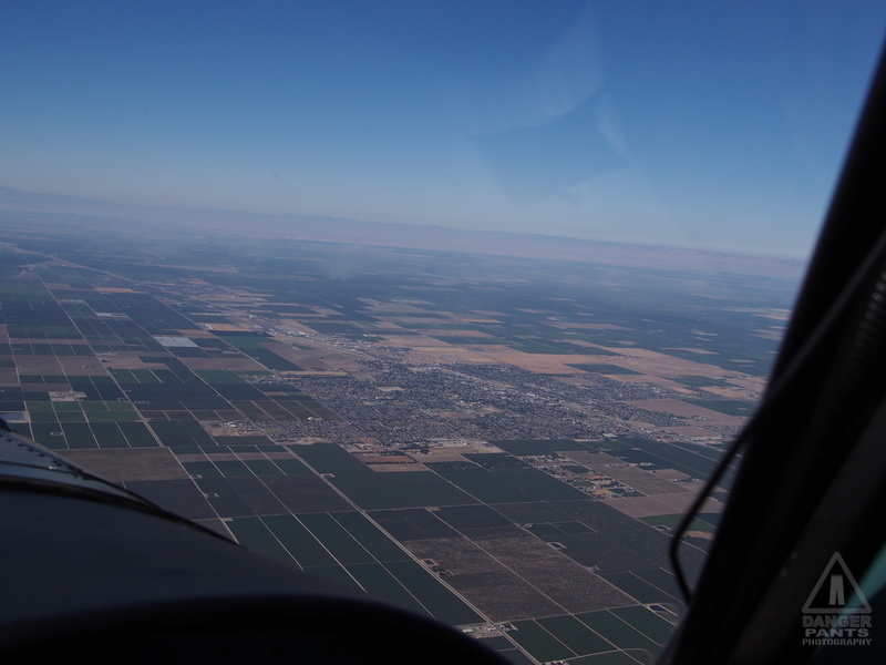
A town amidst the fields, somewhere north of Bakersfield
The flight to Bakersfield was uneventful, and I passed the time by listening to Ruby 2, a somewhat inscrutable sci-fi radio drama from the 1980s that my brother and I used to listen to. Every so often, Bakersfield Approach or Norcal Approach would interrupt the story with a radio call, but since I've had the story memorized for decades, this was no real impediment.
Land in the San Joaquin valley seems to be largely given over to agriculture, which makes sense for an enormous flat plain with lots of sun and reasonable access to water. Occasional towns dot the landscape, connected by long threads of freeways.
Eventually Bakersfield hove into view, and I navigated around Meadows Field (BFL) to the smaller Bakersfield Muni, a few flight-minutes further south. I dropped down and taxied into the parking area for the Rocket Cafe.
The Cafe itself is a large room with a bar, many tables, and profuse displays of sports memorabilia. Pretty much what you'd expect from an airport bar. I ordered an omelette with hashbrowns and a glass of orange juice as I continued reading the pulp WWI book I'd picked up for my brother David, who's researching for a story set in an alternate WWI timeline.
An hour and a half after shutting down the engine, I was firing it up again, wondering how slow the takeoff would be in the heat of a Bakersfield summer day (about 100° F; answer: not substantially worse than all the other fields I'd departed in the high 90s). Breakfast sat comfortably in my belly, and the weather reports around LA had shown complete improvement, so there was nothing to stop me from continuing with the trip (but the air conditioning in the restaurant was sure nice, and I took the opportunity to charge a radio that had been doing excellent work).

I-5 running straight as an arrow toward the pass south of Bakersfield
As I flew toward the mountains, I realized that there was no way I was going to climb high enough to be comfortable before I reached them, so I started doing the flying equivalent of switchbacks, zig-zagging over the valley trying to gain altitude. I initially aimed for 7500 feet, but eventually climbed up to 9500 as the mountains loomed larger.
Because I was so high, the actual traversal of the mountains was completely uneventful, though Norbert's oil temperature was creeping higher with every climb, so I was keeping an eye on it in the heat. I tried to spot the handful of airports that the map showed were present, but only saw one or two. My ability to recognize airports improved noticeably during the trip, but Agua Dulce (L70) remained hidden to me.

The final pass, with LA in the hazy distance
I told my air traffic controller that I would start my descent as I passed over the final mountain toward Burbank, but he had me stay high to allow jet traffic to pass under me. That was an odd feeling, to be flying over the jets in a Champ. I had several altitude holds as I descended toward El Monte (EMT), my final destination. The LA airspace is quite busy.
Finally I was allowed down, and made the approach to El Monte. The tower told me to turn for the base turn into landing over the 210, but since I didn't know where that was (I was directly over it, as it happened), his explanation delayed me until it made more sense to make a straight-in approach. I landed at El Monte and shut down at 1:06 pm, 48 hours and six minutes, and 15.8 flight hours, after I'd departed Harvey Field in Snohomish.
Flying with David
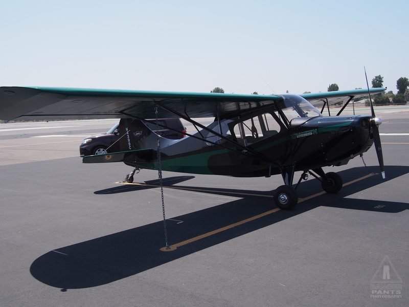
Norbert on the ground at El Monte
My brother has never flown with me before. Since he lives in LA, and I live in Seattle, the factors have never come together before. Additionally, he's preparing to write a story about a plucky young woman who successfully flies a WWI era monoplane against all odds as part of her adventure, and I've been consulting with him on technical aspects of the airplanes and tech in the story. It was completely logical that we should go for a flight together to put some of the theory we'd been talking into practice.
We drove to the airport (a day and a half, and one very welcome shower, after my arrival), and I gave him the preflight speech as we drove. Which control does what, what to do in a variety of foreseeable emergencies, the order of events and what to expect, etc. We went over the plane, and I gave him a narrated preflight inspection. It was all good material for the book.
We strapped in and called the tower for takeoff clearance. I had reset the video camera to record full-speed video, so that he could have a visual reminder of what we'd done. Unfortunately it's not set up to record our intercom audio, which is too bad. We took off to the south, and followed the traffic pattern to depart the area to the northeast. The air was bumpy from all the heat rising off the pavement, though not unusually so.
I had forgotten, in the many years since we were children, that David used to get seasick on the sailboat we had. It briefly crossed my mind that morning, but I forgot to mention it in the preflight discussion. It turns out this sensitivity hasn't changed.
We flew over to the practice area east of El Monte, and discussed the various features on the ground. He mentioned he was feeling a bit ill, so I decided we would avoid the more strenuous maneuvers I'd been planning to demonstrate -- nothing aggressive, but steep turns can be tough on the ol' motion sickness.
I demonstrated a power-off stall (David's wife had given me a very disapproving look when I mentioned we'd try stalls, and I had to explain why it was safe, and wasn't as bad as it probably sounded; in brief, a stall makes the wings fly less efficiently, but if you do it a couple thousand feet in the air, it's simple to recover from, and offers basically no danger -- it's something every student pilot learns to do early on). I demonstrated a power-on stall. David said, "Oh, I think I'm gonna throw up," and I heard him anxiously opening up one of the airsick bags helpfully tucked into a little pocket directly in front of the passenger. The mic went quiet for a minute, then he returned, saying, "Ugh, but I feel better now."
We decided to return to the airport and land, to reassess if it made any sense to continue flying. We were quickly down, and David said he felt better, so I restarted the motor and we went up again, with the goal of giving him at least a few minutes of stick time. Before we'd even made it to pattern altitude, another bag came out, and I called the tower back to ask for a return to the lovely, stable ground.
He felt bad for cutting the flight short, but I assured him it was no trouble: through the previous owner's foresight, there were airsick bags ready for use, and the only downside to the adventure from my point of view was that I had two fewer airsick bags now. I felt bad that the motion was bad enough to make him sick, but there was no way to control it in that situation. It's too bad we didn't go flying on the previous, overcast day, simply because the air probably would have been calmer. But, as he said, hindsight is 20/20. He was still able to get up in the air, and despite getting ill, had a good time. Who knows, maybe his plucky young woman adventurer will also suffer a bout of airsickness, now.
Next: Can a Champ really fly from LA to Ashland in one day?
Posted at 19:57 permanent link category: /aviation
Sat, 19 Aug 2017
Seattle to Los Angeles in a Champ: Day 2
In the previous episode, I described getting myself from the Seattle area to Ashland, OR.

Hint: my tent is in the corner
I didn't sleep well in Ashland, overwhelmed by the sound of crickets and cars occasionally driving by on the road behind the airport. I was too warm to start, and then too cold until I woke up and dragged the sleeping bag over me. The sky started lightening around 5:30, and I was thoroughly awake by 6.
I'd planted the tent in front of a parking spot for the Brim Aviation hangar. As I was making my somewhat bleary way to upright, someone parked further down the lot, and came over, asking if he could help me (I had the impression he thought I was homeless). I explained that I was flying through and had sought a dark place to sleep, and he laughed. He said it was a good thing I was up, because they were about to get really busy with fire-fighting flights.
I finished packing myself up, and got the weather briefing on the phone (I was pleased to find that the terrible cell coverage I'd expected was actually pretty good, particularly once I was on the ground). Nothing of note except the smoke, which was going strong from a number of local fires. Norbert looked surprisingly majestic in the early-morning light as I packed up and got myself ready to go.

Norbert in the sunrise light
I got myself oriented, and taxied out to runway 12, surprising a deer as I went. It bounded over a wire fence, then turned to look at me curiously as I trundled past in my green and black plane. I lined up on the runway, and launched at 8:18 am. Someone had called on the advisory frequency that there were a pair of heavy military helicopters transiting the area, and they passed me by as I climbed away from Ashland, making altitude to get over the pass just south of town.

Two heavy military helicopters passed me by
Up and over the pass -- for some reason, it was really fascinating to see the roadworks under me as I flew over I-5 -- and into the valley beyond, for my first tantalizing view of Mt. Shasta. The smoke was pretty heavy, and I ended up climbing all the way up to 9500 feet (the highest altitude I aimed for on this trip, though I reached it several times) to get clear of the smoke. The smoke continued to have its interesting scent, but I blew my nose orange afterwards, so I think I'm happier to have not lingered there.
The route that I-5 follows after Ashland is well defined by a series of distinct small mountains to the east. I had a vague impression that they might have been formed by a giant putting down a series of toy mountains and arranging them for a pleasing visual effect. Of course, I viewed all this through a layer of smoke, and the haziness contributed to the dreamlike feeling of it.
Onward and upward. I finally reached 9500 feet, and leveled out to cruise above the smooth white layer of smoke. I noticed an odd optical illusion, where when I looked at something that I thought was level with me, evidence told me it was actually lower. For instance, I would have sworn the smoke layer was level with me as I passed Mt. Shasta, but I knew for a fact that it was between five hundred and a thousand feet below me. The illusion was particularly strong when looking at mountain peaks. I'd spot one that I was sure I'd smack into if I flew over it, and on the chart it said the actual elevation was two thousand feet below me.

Mt. Shasta from 9500 feet, civilization just visible below
Once past Mt. Shasta (which has its own weather station, that I tuned into as I passed), it was over the many-tentacled Shasta Lake, and on to the broad, flat valley that starts at Redding, and continues south all the way to the Grapevine mountains that spread north of LA.
My next stop was at Willows (WLW), which I had initially (ha!) planned to be my first day's stop. It took me nearly 3 hours to fly from Ashland to Willows, and although I could have done it had I launched exactly on schedule, I'm really glad I didn't. The remainder of the flight to Willows was unremarkable except for one thing: the temperature inversion.
As I descended into Willows, the temperature on my $6 aquarium thermometer (with the temperature probe jammed into the little fresh-air vent around ankle level), the temperature slowly climbed from about 20° C at altitude to the high 20s, then there was a palpable spike. I wasn't looking at the meter as I descended, but I could feel it as I passed into the inversion. Suddenly it seemed like it was 10° C hotter.

Willows, CA (WLW)
On the ground in Willows, it was hot and dry. I pulled up to the self serve tank, and filled the plane up. I had been in communication with Glenn, who I was hoping to visit in Placerville (PVF), both to meet him, and to see his airplane. As you can read elsewhere, I'm just starting on a project to build a Marquart Charger biplane, and Glenn is a huge proponent of the type online. When he moved to California as I was planning this trip, it was obvious I'd have to stop in.
So, I launched from Willows just past 11:30 am, and climbed to 7500 feet, as much to escape the heat as anything else. I flew past Sutter Butte, which is an odd sight in the middle of the otherwise completely flat plains of the valley. I had to give Beale Air Force Base a wide berth, as they had a Temporary Flight Restriction around the field, which seems to be pretty much perpetual. Once I was around that, it was direct to Placerville.

Placerville is somewhere in them thar hills
The approach to Placerville was hillier than I'd been expecting. The map shows that it's in the foothills of the mountains, but somehow it doesn't make clear just how hilly it really is. As I dropped down once I was finally sure I had the field in sight (I didn't want to lose altitude until I was sure where I was going to land: the Champ is not a quick climber), I traded radio calls with someone else who was departing, and fought the controls a bit as the wind tossed me around. I braced myself for a difficult landing. It was on the "handful" side of the "easy-peasy:handful" spectrum, but manageable.
As I was tying the plane down, I got a text on my phone: "We're sitting at Norbert's ten o'clock in the open hangar." I walked over and shook hands with Glenn and his wife Judi, and we immediately started into the biplane talk. We've been conversing online for many months as I've sorted out what kind of biplane I wanted to build, and we were immediately comfortable talking planes.

Glenn's Charger
Glenn showed me over his plane, and some of the special touches the builder put in. I sat in the cockpit and noted how I fit -- generally pretty well, though the rudder pedals were a bit closer than I really wanted them, but it's simple enough to get them placed properly while building. My plane will definitely have the pedals in the right spot, and I will hopefully build them in such a way that they can be moved for different pilots (though perhaps not easily).
Glenn kept glancing apprehensively at the windsock on the runway, and I could see why. It would swing back and forth between running directly down the runway (good) and straight across the runway (bad). The fact that it was variable was the worst part of the situation, though. It would make landings in the comparatively twitchy Charger somewhere between "handful" and "disastrous" on the ol' spectrum. "Easy-peasy" was not in the offing. So we decided to go to lunch instead. We had a lovely Mexican lunch at the base of the hill on which the Placerville airport is perched.
Back at the airport, the weather had calmed just enough that Glenn was willing to go flying, so he prepped the plane and pulled it out. I slipped on the flying helmet and goggles, he fired up the engine, and we taxied out to the runway.
The takeoff was interesting: the movements of the plane were much more sharp and definite than the Champ. The tail raised abruptly, and we lifted off very definitely, with none of the "yeah, sure, I guess" feeling the Champ conveys. Of course, it's got 60 additional HP (150 vs. the Champ's 90), and only weighs a hundred or two hundred pounds more.
We climbed for a minute or two, chatting over the intercom as we flew. My microphone was quiet, so I found myself covering the mic with my hand and leaning forward to avoid the wind noise that constantly threatened to drown me out.
Glenn gave me control of the plane, and I did some gentle maneuvers -- we were both feeling full of heavy Mexican food, so aerobatics were definitely not in the cards -- getting a feel for the plane. For the short time that I flew it, it was very pleasant and really just felt like an airplane. There was nothing surprising about it, it just did what I asked it to do. I wasn't willing to wrench it around between my lack of experience and our full bellies, but my time at the stick was pleasant.
I noticed that I also felt much more in control than my last open-cockpit flight, in Oregon with Dave in his Starduster. Not that anything was substantially different beween the Charger and the Starduster; I think the big difference was between my ears. I was much more mentally prepared this time, I think.
When we were back down, they offered me a place for the night in their spare room, which was a very tempting offer (particularly as I thought back on the night half-awake in a tent in Ashland). However, I felt a powerful urge to keep moving: LA was still over 300 miles away, and I needed to cover more distance.
So, I bade them a fond farewell, and went back to my plane. I filled it up with gas as the wind gusted around me, and taxied out to the runway. Glenn and Judi were right behind me, bound for an ice cream social at a nearby airpark. It was funny to watch their short flight on my ADS-B display, which shows a map overlaid with my route, and other airplanes in the air around me. I took off just before 5:30 pm and aimed myself southward for somewhere between Fresno and Bakersfield.
My destination wasn't exactly set in stone. I'd targeted Porterville (PTV), which has the cheapest fuel in the area, but the GPS remained insistent that I would arrive about 15 minutes after sundown. Since the plane isn't legal to fly at night, I considered my other options. Cell coverage came and went at random in the air, and I tried several times to look up the local airports online as I flew. I finally got my search result back, and decided on very little information to try for Mefford Field (TLR) in Tulare. The fuel price (five cents per gallon higher than PTV) was the only definite fact I had, but I assumed based on its size and location that there would be facilities like a bathroom available. The GPS said I'd be there just before sunset, so I decided that was good enough.
Flying a plane built in 1956 when you're my size is always a compromise. Planes were built for the size of the average person at the time, which was about a 5' 7" man who weighed 150 lbs. I am... larger than this. The problem I was really running into was that my legs are longer than the stretch to the pedal was designed to accomodate. Add to this that my body has started getting painfully stiff in the knees if I sit in one position for too long, and there was a recipe for some trouble.
I had discovered as I flew down to Ashland that I could cross my legs around the control stick, though this left the problem of cruise rudder: the plane needs a pretty constant 3 or so pounds of pressure on the right rudder pedal. It's not a lot, but if it's not there, the plane flies a bit crooked (or "uncoordinated" in pilots' parlance). An uncoordinated plane is basically flying with one side to the wind, which makes everything less efficient and increases drag by a lot.
The thing I realized as I sat there with crossed legs was that the rudder pedals for the passenger (who sits behind the pilot) are right next to the pilot's seat. I could drop my hands right onto the rudder pedal on either side of my seat. So, I just added that rudder pressure with my right hand while I flew with my left. It was hard to coordinate the controls, but I worked on it as I flew and slowly got better.
Crossed legs didn't solve the problem that I really wanted to straighten my legs, but at least it resolved the issue of keeping my knees in only one position for the entire flight.

I think those are house boats
Flying over the hills toward Mefford, I passed a number of lakes that seemed to have a series of house boats on them. There was no obvious way to get to or from the house boats, so I'm not sure what the deal was with them. Perhaps there was some kind of water taxi available.
I had a small monocular (basically a compact telescope) with me, and it came in handy any number of times to identify things on the ground, or occasionally other planes. Telescopic examination of the little white dots on the lake suggested they were house boats, mostly because I couldn't imagine what else would be shaped that way.
Soon enough I was past the hills and back out over the flat valley plain. It was another race with the sun, but the sun had a dirty trick up its sleeve: as I went further south, sunset got earlier and earlier. Still, I was once again able to get my wheels on the ground a few minutes before the sun completely disappeared below the horizon.

Norbert faced by a large crop duster the next morning
Mefford Field was not really what I was expecting, though it made perfect sense for where I was. There was a self-serve tank, and I'd noted a sign for Johnston Aviation pointing the opposite direction of where I was going. But other than that, there was a small crowd of very distinctive looking agricultural spraying planes: crop dusters, and not much else. There was no FBO (fixed base operator, the jargon for the typical pilot services business found on most airstrips), and it became increasingly obvious that I would have no access to a bathroom. I picked a tiedown spot that was further away from the lights, and noted with interest the dust skittering away in the wind as I pulled the chains out of their recesses in the pavement to hook the plane to the ground.
Tied down, I pitched my tent, suddenly aware of the noise of the freeway only a couple hundred feet away. The pavement radiated heat, adding to the heat that was already in the air -- I took a picture with the thermometer in the background, blurrily showing what I think is 37° C (98° F). I am not a great fan of heat, and I knew it was going to be an uncomfortable night. I thought harder about finding a hotel in nearby Tulare (pronounced "to-larry"), but laziness overcame me. I washed my face off at a hose attached to one of the hangars, and did my best to sleep on my thankfully insulated sleeping pad.
Next: Over the Grapevine and flying with David
Posted at 21:04 permanent link category: /aviation
Fri, 18 Aug 2017
Taking That Long Cross-Country
Last year, I took a long cross-country flight in a rented Piper Warrior, from Seattle to Mono Lake in California, just east of Yosemite National Park, about as far south as San Francisco. It was a cool trip, but it was breathtakingly expensive at $130 per hour plus tax.

Norbert
So this year, when I found myself the owner of a 1956 Champion 7EC (known affectionately as Norbert, after the dragon hatched by Hagrid in the first Harry Potter story), it occurred to me that I should look at another long cross-country. I fixed my sights on Los Angeles, so that I could visit my brother: we rarely get to spend any time together, and when we do, it's always in the context of a family gathering like Thanksgiving or Christmas.
I just returned from the flight (like, this evening -- I should be taking a shower and going to bed, instead I'm sitting here writing), and wanted to relay some of the more interesting parts.
I planned to take a week to make the trip: I'd fly down on Saturday and Sunday, hopefully stopping in Placerville to visit a friend who has a Marquart Charger biplane. David (my brother) and I would hang out for a couple of days, go flying, etc., and I'd return later in the week, again taking two days. I'd take a week off from work to accomplish all this, and hopefully have a few days at the end to recuperate.
As the time was running out to my week's scheduled vacation, Seattle welcomed (if that's the right term) a choking haze of forest fire smoke from nearly 100 fires burning in the interior of British Columbia to the north. I tried going flying the weekend before I was to leave, and basically had to turn around and land after half an hour -- the smoke just kept getting thicker, until I didn't feel I could safely fly through it any more. I just couldn't see well enough.
So there was some anxiety about my ability to leave on Saturday morning as planned. Fortunately, the weather seemed to be on my side, and late Friday night, a westerly wind came in and started clearing the smoke. Of course, in its place, it left a low overcast, so my start on Saturday was still delayed for three hours, waiting for the clouds to lift a bit.

Packed to the gills, I say!
I was eventually able to take off on Saturday, the plane packed relatively to the gills with Stuff: I was planning to pitch a tent next to the plane on my overnight stops rather than finding a hotel and doing all the phoning and taxicab riding necessary for that eventuality. I'd realized when I got to the detailed planning that there was no way I'd make it to LA in two days if I was going to stop and hang out to talk biplanes for half a day, so the plan was now to stop the first day in Ashland, near the Oregon-California border, and again somewhere in the valley, between Fresno and Bakersfield.
Norbert, being a Champ 7EC, is not what you would call a speed demon. In perfect conditions, it cruises at about 85 MPH. If you're trying to burn all the gas as fast as possible, it'll cruise up to 105 MPH, but the plane is perceptibly unhappy at that speed. So I banked on about 85, forgetting about (or, perhaps, imagining improbably favorable) wind.

Downtown Seattle is somewhere out there in the haze
So, I launched in the early afternoon of Saturday. The smoke was still a distinct presence as I left, and it would become a running theme of the trip.
I ended up recording time-lapse video of the entire trip, which will be posted later, once I've had a chance to catch my breath a bit.
The first leg would take me from Snohomish, north of Seattle, to Stark's Twin Oaks Airpark (7S3; every airport has a code, like SEA for SeaTac, or PDX for Portland International), in Hillsboro, OR. I had planned on about two and a half hours, and it ended up taking almost three. I planned to fly the route at 9500 feet to save fuel (the plane is more efficient the higher it flies) without giving sufficient thought to the wind at different altitudes. I averaged 70 MPH on that leg. The only reason it went any faster than driving a car is that I could fly in a straight line, and didn't have traffic to deal with.

Mt. Rainier in smoke
Once at Twin Oaks, I fueled up and ate half the sandwich I'd brought. After too much dithering, I bought a quart of oil after I used the quart I'd brought with me, then I was off again, bound for Roseburg (RBG).
The flight down to Roseburg was unremarkable, except for the continued presence of the smoke. There were particular altitudes where it was concentrated the strongest, and flying through them smelled like someone had turned campfire smoke into a candy, and I was smelling the result. It was pleasant and nostalgic and vaguely disturbing all at the same time.

Dashcam shot of the industrial fuel pumps at RBG as I taxied up
Roseburg was a cool little airport, just off I-5, and tucked neatly between all the hills. As I flew the traffic pattern to come in for a landing, I was very nearly level with some rich-looking houses on a hill west of the field. I found myself wondering if those rich people had expected to have ratty small plane pilots looking in their windows all day, when they bought their fancy house on the hill. Refuelling at Roseburg was bizarre, as the fuel pump looked like something designed by a Windows 95 screensaver, and it took me almost ten minutes to figure out how to actually ground the plane, turn on the pump, and pump my gas. The only reason I made it under ten minutes is there was an airport geezer (this is a term of affection for people who hang out at airports watching the planes come and go) who came over and offered his insights into the industrial-looking system. I regret not taking a picture, but I was in a hurry. (Update: found a shot of it in the time-lapse footage!)
Norbert is an odd plane in one way: it has navigation lights and a landing light, but it doesn't have a rotating beacon or strobe light. You need at least nav and either beacon or strobe to be legal to fly at night, so Norbert is not technically night-legal. There's no one around who would bust me for it, but I make every effort to not fly in the dark.
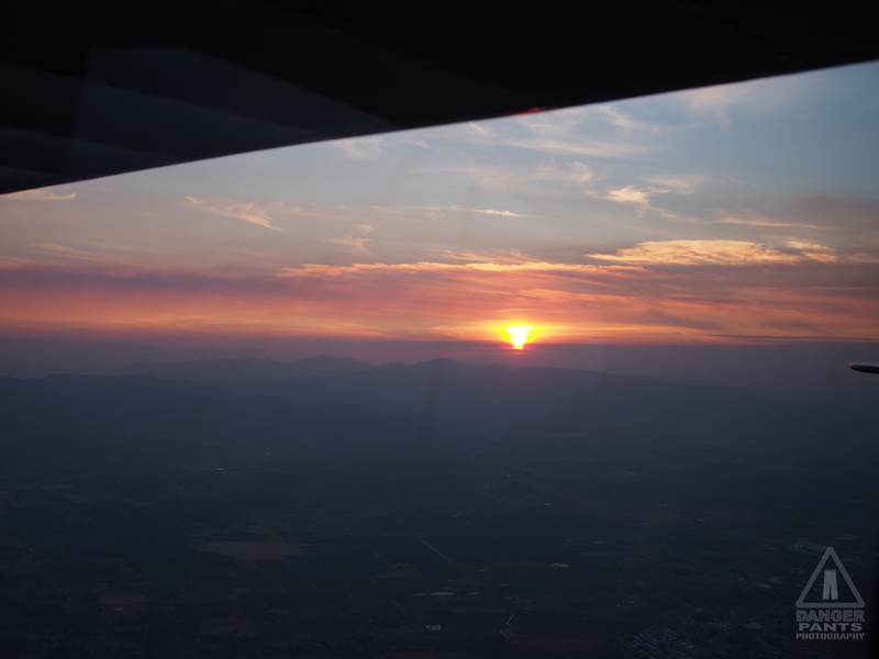
A smoky sunset from the air near Ashland
The reason I was in a hurry leaving Roseburg was that by my calculations, I could just barely reach Ashland (S03) by sunset, which is the legal limit for this plane. I'd previously called the airport, and gotten permission to pitch a tent there (other airports I called all gave me a very CYA "no camping allowed" response, with various poorly-reasoned excuses offered along with the official policy).
So I poured on the meager coal (Norbert is not a powerhouse), and shaved a corner off my flight from Roseburg to Ashland: I'd planned to follow I-5 (giving me a convenient if highly dangerous emergency landing strip -- I plan every flight for the contingency of the engine giving out, since I've only got one), which would have meant flying to Grants Pass (3S8), then onward to Medford (MFR) and Ashland. I decided instead to go up to 9500 feet, giving me extra clearance over the mountain peaks, and fly directly from Roseburg to Medford. I lost the safety net of having the freeway nearby, but it meant I would make it to Ashland before sunset.
Once I was committed to my path, I started to question my own judgement. The smoke was pretty thick, and the sun angling through it from near the horizon made it completely opaque to the west. I could still see to the south, in my direction of travel, but when I looked west to spot the comforting ribbon of I-5, the smoke shook its proverbial head and said, DENIED! I pressed onward.

Rogue Valley International through the smoke
It was with some relief that I spotted Medford's Rogue Valley International Airport (MFR). The mountains I crossed to get there were particularly forbidding-looking in the smoke. I told Air Traffic Control that I was going to descend to below the smoke deck, since the remaining distance to Ashland would pass quickly. I kept glancing behind me and at the clock, and managed to get wheels down in Ashland just as the sun dipped below the horizon. I was within a minute of arriving too late. After having left Seattle three hours late, I was astounded the timing had worked out so well.
I gassed up the plane and pitched my tent behind a hangar, trying to get myself away from all the sodium-vapor lights around the airport, and the rotating beacon (a green and white rotating light that advertises a land airport to the night flyer, but also sweeps the airport grounds every few seconds). The Ashland layout was pretty nice: there was a bathroom available, and the tiedown fee was a mere $7 per night. There was even a picnic table, at which I had the other half of my sandwich for a late dinner.
It was with contentment at my accomplishment that I lay my weary head down to sleep, and listened to the crickets going mad in the dark around me.
Next: the flight to Placerville, and flying a Marquart Charger biplane
Posted at 22:19 permanent link category: /aviation
Categories: all aviation Building a Biplane bicycle gadgets misc motorcycle theater