Categories: all aviation Building a Biplane bicycle gadgets misc motorcycle theater
Tue, 22 Aug 2017
The Final Episode: From Ashland to Seattle

My "campsite" in the dawn light
Previously: Can a Champ really fly from LA to Ashland in one day?
I awoke on Friday morning ready to face the day's flying. As usual, I woke up as the sky showed the sun's progress toward our horizon. The placement of the airplane between myself and the sources of light worked well, and my sleep that night had been a bit more restful than previous nights in the tent. It wasn't as if I was sleeping in my own bed, but I had at least gotten the temperature right, and didn't wake up as many times in the night.
In my planning for the flight back, I had looked at the flight from Ashland (S03), and reconsidered my fuel stop. On the way down, Roseburg (RBG) had made sense to give myself two-hour legs headed south, but it left me with only an hour and a half necessary to reach Ashland. I wanted to start the day with a longer flight, so I had filed the flight plan to Eugene (EUG), an additional 60 miles beyond Roseburg.
A flight plan for my kind of flying is an interesting beast. Its main purpose in life is to have someone else there to check in on you. It is effectively declaring, "I will fly from XYZ to ABC, leaving at this hour, and taking this long to do it." When you take off, you call up the local Flight Services station on the radio, and ask to activate your flight plan, giving the actual departure time if it's different from what you planned.
The plan is opened, and practically speaking, nothing further happens until you either close the plan, or the time enroute expires. If the time expires, they have an escalation policy, that goes something like:
- Call the pilot
- Call the alternate contact
- Call the destination airport
- Talk to ATC
- Scramble Search and Rescue
If the first step doesn't yield any results, they move on to the next step, trying to locate the pilot who is now overdue. They keep moving up the steps until they find you, dead or alive.
Usually, I'm pretty good about remembering to give them a call either on the radio shortly before I land (wherever I land is inevitably outside radio range once I'm on the ground), or on the phone shortly after I land. On the one occasion this trip where I forgot to call and close my flight plan, I got a call within about a minute of the planned arrival time, and I sheepishly said that yes, I was down safely, and apologized for not closing the plan.
The cool thing is, it's really quite effective. If I were to have a problem enroute, I have a double safety: I'm talking to Air Traffic Control to have them watch out for traffic that might get too close, and I've got the Flight Service folks who will trigger escalating searches for me if I don't show up at the planned time.
ATC, being in contact with me, is very likely to get a call from me saying something's wrong, if something goes wrong. I carry a spare, battery-powered radio specifically to cover the case of a full electrical system failure. Even if they don't get a radio call from me, I've told them where I'm headed, and if they see me suddenly descend or go wildly off-track, they'll call me trying to figure out what's going on. If they can't reach me and I drop off the radar, they note where I dropped off, how fast I was going (both laterally and vertically) and what direction I was headed. They now have a very good idea where to send the SAR folks.
If, for some reason, ATC doesn't notice me drop out of the system, Flight Services will start ringing bells when I go overdue. All the radar information and radio calls are recorded for later review, or to assist with a search operation. By having myself logged in to the system to use VFR flight-following (which is the term for this kind of casual ATC contact), they will specifically track my plane, and can identify it on the radar screen at all times.

Heading out of Ashland, toward Medford
In any case, I had filed the first flight plan of the day for Ashland to Eugene. It would be something like two and a half hours, but I had discovered that I could withstand 3 hours in the plane at a time. My estimation of which was the biggest problem with the pilot's throne in Norbert vacillated between the coccyx-bending seat cushion and the lock-kneed rudder pressure, but as time went on, the tailbone pressure was winning the award for Most Annoying.
I don't know if you've experienced continuous, unshifting pressure on your tailbone for any real length of time, but if you haven't, take it from me that it is a literal and very real pain in the butt.
I had decided that for this leg, I would not take the shortcut over the mountains that I had taken on the way down, direct between Medford and Roseburg, skipping Grant's Pass (3S8). I wasn't pressed for time now, and preferred to keep the big safety net of I-5 under me.

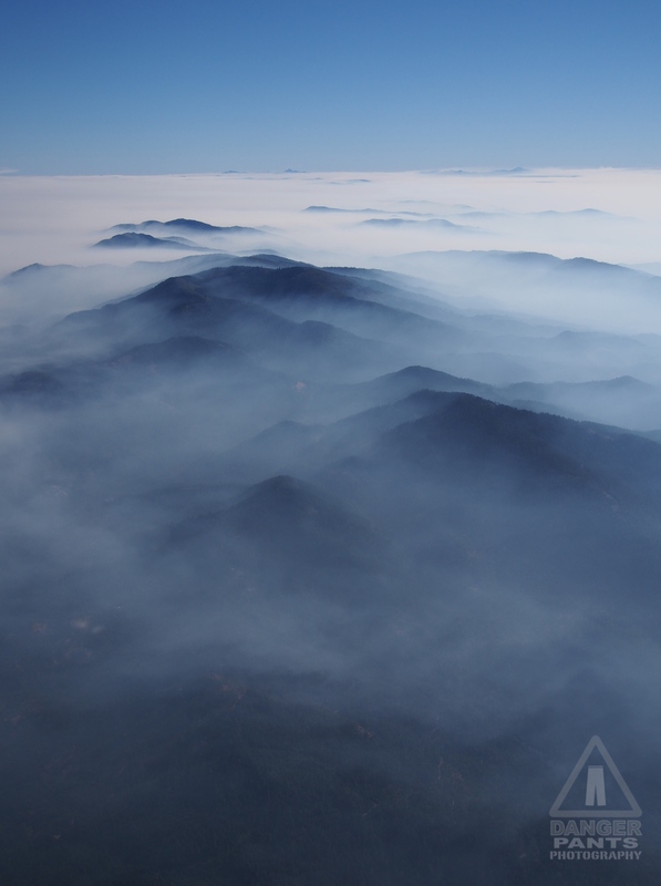
Mountains peeking above the smoke
I'm very glad I followed my planned path. I ended up seeing the most ridiculously beautiful smoke + mountain vistas. The pictures don't really do the sight justice, but I'll see if I can do a bit of post-processing later to bring out what I was seeing from my fabric-covered cockpit.

Smoke swirls across the landscape like water flowing in a stream
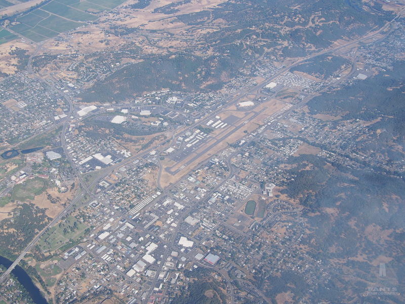
The smoke cleared as I hit Roseburg, and I was treated to the sight of my previous fuel stop from 8500 feet in the air.

Roseburg (RBG) from above. North is to the upper-right.
The hills that housed Roseburg gradually smoothed out, and turned into foothills, which turned into ripples, followed by plowed fields, until I was looking down runway 34R at EUG. ATC directed me to make a straight-in landing to runway 34R, which makes my longest-ever straight-in approach, of something like 30 miles.
The amount of time it took to actually descend and reach the runway was kind of comical. I was still going the same ~85 MPH as I'd ever gone, but it was like one of those uncomfortable sketch comedy routines where it just keeps going and going. It goes from funny to annoying to boring to really annoying to funny again. I could only imagine the poor controllers in the Eugene tower were looking pointedly at their watches, kindling a fire on the exterior platform and pointedly roasting marshmallows, pointedly spawning new generations of controllers, and generally making a big deal out of how very slowly I was moving. Not really, but it was fun to think about.
I got clearance from the tower to land on 34R pretty early on, maybe 8 miles out. It really was ridiculous how long it took me to actually arrive and land.
I did finally touch tires to tarmac, and after a minor miscommunication with the ground controller, got myself taxied over to the self-serve fuel. There was a lovely Fairchild high-wing monoplane just taxiing away as I pulled up, and I gave them an enthusiastic thumbs-up out the window. It took me 2.5 hours from Ashland to Eugene, and obviously most of that was the approach to landing. I had departed Ashland at 8:40, and shut down in front of the fuel tanks in Eugene a few minutes before 11. (If the math seems a bit off, I had started the motor ten minutes before I departed Ashland, and the official 2.5 hour time is motor-start to motor-shutdown.)
Eugene was a brief stop, and I was quickly back in the air and headed for Scappoose (SPB). I had briefly toyed with the idea of stopping in Salem for lunch, but I really wasn't feeling hungry, so I decided to stick to the original plan. As I flew past Salem, I was glad I'd kept to the plan, since it appeared too quickly after I'd taken off, so that I would have felt like I'd flown too short a leg.
The flight to Scappoose was unremarkable, until Seattle Center handed me off to Portland Approach. Portland was apparently busy that afternoon, and I was shuffled past Hillsboro (HIO), and commanded to "Maintain VFR flight at or below 4000 feet." Normally they give a nice "Descend and maintain" instruction, but this was like a gym teacher saying, "Drop and give me 20!" I lost altitude from 6500 as quickly as I figured was prudent, directly over the Hillsboro airport. There was a mass of dots on my traffic display over Hillsboro, but I figured 4000 feet would still be well clear of them.
Finally I was given the instruction to resume my own navigation, and I continued over the ridge toward Scappoose, one eye tracking an airplane 1500 feet below me that was zigzagging around directly below my flight path.
Scappoose was also experiencing an aerial festival of some sort, and I counted at least four aircraft calling positions in the traffic pattern over the airport. I found my way behind a twin, and followed him in to land, glad that we were landing to the north, so that my taxi to fuel wouldn't take as long.

Norbert with Dave Baxter and son's Stardusters
I noticed as I taxied in that there were temporary-looking signs declaring a ground control frequency. Then I noticed a blue biplane crossing the runway, and called on the radio to see if it was who I thought it was. Yep: Dave Baxter, unofficial head honcho of the Starduster Too fanclub. That made two unofficial biplane head honchos I'd run into on this trip.
I gassed up, and chatted with another pilot in line for fuel, who had a slightly cartoonish looking composite Light Sport plane (I wish I'd taken a picture), which he said flew 150 knots or something ridiculously fast like that, using a Rotax 912, which is more or less the same engine as in Norbert (note to airplane people: I know, I know -- I'm writing this for everyone though, not just aviation nerds). It was hard to believe it was so much faster on just 10 HP more.
While I was there, I bought another quart of oil at the FBO, even though the oil level in my engine hadn't reached an uncomfortably low level. I wanted to check my hypothesis that the oil temperature on climb would be lower with more oil in the tank.
Then I taxied over and parked Norbert next to Dave's Stardusters to say hello. I flew with Dave last year, when he very kindly took me up for an hour of Starduster time, which was also my first time in an open-cockpit biplane. We chatted for a bit, and he ran off to get me some spare temper foam he had lying around, to see if it would help with my increasingly uncomfortable seat.
I had to excuse myself again as I had with Glenn and Judi in Placerville, since I wanted to continue on. I felt bad, because Norbert was a logical addition to the vintage aircraft fly-in they were having. It would have been interesting to stay and see what other cool vintage planes showed up, but I knew I had hungry kitties at home who would be sad if I didn't feed them.

Headed toward Kelso and some friendly puffy clouds
My parents' house is in Scappoose, and I debated flying over it to make sure it was still standing, but decided I needed to make forward progress rather than lollygagging around. I continued my climb toward Kelso (KLS), oddly pleased to see a layer of puffy clouds -- I was finally back to weather conditions that made sense to my Northwest-raised brain. I had initially thought to fly this leg at 6500 feet, but ended up climbing further for 8500 when I saw that the clouds topped at around 5000 (technically I only need 1000 feet over the tops of the clouds to be legal, but legal and comfortable are different things).
I noticed as I climbed that the oil temperature was indeed a bit lower. The highest temperature I'd noticed in climb was about 215° F, climbing out of Bakersfield to cross the Grapevine, with 3.9 quarts in the engine. The climb to Kelso was with 5 quarts, and the temperature only reached about 195°. Just flying around Seattle, the highest I'd previously seen was about 180°.
Around Chehalis (CLS), I started to worry that the clouds were bunching up, and that I might have trouble finding a hole to get through further along. There was a handy break in the clouds just under me, so I called ATC and told them I'd be "maneuvering" to get below the cloud deck. If you count a more than 90° turn and droppling like a rock through the hole as "maneuvering."
I found myself now flying at 3200 feet over the rolling hills of central Washington, and the flight had gone from perfectly smooth to rough and tumble as the wind rolled over the hills and took me on the rollercoaster with it. I aimed for Olympia Regional (OLM) to avoid some military airspace that chatter on the frequency had suggested to me might be active. I reached calmer air as I got over the water south of Tacoma Narrows (TIW).

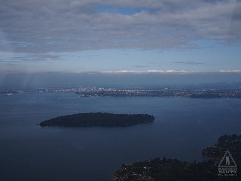
Seattle in the distance, beyond Blake Island
Now in the home stretch and on my home turf, I cruised up the Kitsap Peninsula, over Winslow on Bainbridge Island, and crossed the water to get a picture of my house in Ballard, then diagonal up to Harvey Field.
While I was looking for my house in Ballard, the controller called me up, and mentioned that I was 200 feet below the approach path of a major turbojet route. Alarmed, I asked him if I needed to change where I was flying, and he clarified: he was commending me for using flight following in the area, and said they were trying to advertise to pilots that they should do this around Boeing Field (BFI). I concurred heartily and assured him that I was usually talking to ATC if I was flying here (which is true). He voiced his pleasure at hearing this. It was an interesting exchange, because I frequently think of requesting flight following in the Seattle area as being a burden on controllers rather than something they want to be doing.
He cut me loose as I crossed the north end of Lake Washington after warning about a business jet crossing my path 500 feet above (quickly spotted, unlike most of the traffic that ATC calls out for me). I made my descent over the ridge, called a few position reports, lined up for a longish base leg into runway 33R at Harvey Field (S43), and was quickly on the ground and rolling for my hangar after a pleasantly smooth landing.

Norbert safely tucked into its hangar
Groaning a bit with the exhaustion of flying 15.7 hours in two days, I heaved myself out of the cockpit, and slowly unpacked the plane. I repacked all my stuff into the car. I did the post-flight tasks. I didn't really want it to be over, but it was time to go home.
I accomplished my goals for the trip: I flew to LA in a 1956 Champion 7EC; my flight planning was sufficiently good that I was opening all my flight plans within half an hour of expected departure; I got to fly with my brother; I got to visit a Marquart Charger and go for a short flight. Even the weather had mostly cooperated (though I would have accepted less overcast at the start, and less heat through central California).
There are no profound lessons to be learned from this flight. Or, if there are, they'll come to me over the next year or two. There are some mundane lessons, like, "Remember to check the winds aloft," or "Find a better seat cushion," or "It is possible to pack that much stuff safely into Norbert's baggage areas." Even, "Yes, it really doesn't go any faster than a slightly speeding car, but at least you can fly in a straightish line."
Returning to work this week has been a little bit of a let-down. I'd rather (as the license plate frames say) be flying.
Posted at 23:30 permanent link category: /aviation
Categories: all aviation Building a Biplane bicycle gadgets misc motorcycle theater